 Forum
ForumGarmin - City Navigator Middle East & Northern Africa NT 2014.10
Requirements: garmin devices, PC
Overview: Navigate streets in the Middle East & Northern Africa with confidence. City Navigator Middle East & Northern Africa NT provides detailed road maps for your device and boasts thousands of points of interest throughout the region, so you can navigate with exact, turn-by-turn directions to any address or intersection. Route to restaurants, gas stations, lodging, attractions and more. Powered ...

- Contact •
- FAQ •
- Register •
- Login
- View unanswered posts • View active topics
-
 Board index ‹ Site map ‹ News of NaviTotal.com
It is currently Thu Nov 27, 2025 2:55 am
 News of NaviTotal.com
Site map of NaviTotal.com » Forum : NaviTotal.com
NaviTotal.com is a community where you can find all needed for your GPSCity Navigator Middle East & Northern Africa NT 2014.10
Read more : City Navigator Middle East & Northern Africa NT 2014.10 | Views : 10507 | Replies : 19 | Forum : New Maps
Garmin BlueChart g2 HEU801X - Europe-N/W Atlantic-Iberian Pe
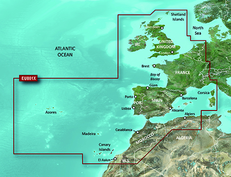
FID 2819
Garmin BlueChart g2 HEU801X - Europe-NW Atlantic-Iberian Pen v14.50.part1.rar
http://www.share-byte.net/N1CnxU
Garmin BlueChart g2 HEU801X - Europe-NW Atlantic-Iberian Pen v14.50.part2.rar
http://www.share-byte.net/SQS2v0
thanks caty
Read more : Garmin BlueChart g2 HEU801X - Europe-N/W Atlantic-Iberian Pe | Views : 6656 | Replies : 1 | Forum : New Maps
Need help Tomtom one XL imposible to update.
Hi there , i having hard time to update my tomtom xl, at first I needed to do a low level format, to fix what it seem to be memory problem. Now does its normal it take about 4 hour to transfert all the file from my pc to the gps.
This is what my stock gpd look like and its 1 gb.
DeviceName=TomTom XL
DeviceVersionHW=ONE XL (v9)
DeviceSerialNumber=
DeviceUniqueID=
RamDiskVersion=20090817
BootLoaderVersion=55136
CurrentMapVersion=835.2423
Has ...
This is what my stock gpd look like and its 1 gb.
DeviceName=TomTom XL
DeviceVersionHW=ONE XL (v9)
DeviceSerialNumber=
DeviceUniqueID=
RamDiskVersion=20090817
BootLoaderVersion=55136
CurrentMapVersion=835.2423
Has ...
Read more : Need help Tomtom one XL imposible to update. | Views : 1623 | Replies : 11 | Forum : General Discussions about TomTom
Could not view folders in wind 7 PC
Dear All,
I have a OBU running Navitotal Papago X8.5 software dated 2010. With help of car accessories shop to load the SLA Map to the SD card, charges S$60. I would like to copy the SLA map to me my pc but was not able to view the folders in my PC.
Can anyone here help how to view the folder in my pc?
Many many thanks in advance
Alvin
Read more : Could not view folders in wind 7 PC | Views : 6443 | Replies : 15 | Forum : PaPaGO! Discussion and User Support
TTS in PRIMO not working...
hi guys, im using PRIMO v9.6.7.235654 on my IceCreamSandwich Android SmartPhone.
I just can't seem to get TTS voices to work...
whats the proper procedure?
once i have the TTS VOICE ZIP file,
and placed it in CONTENT/VOICE folder,
do i still need to install a TTS engine like lets say SVOX?
and buy a voice for it too?
thanks!
I just can't seem to get TTS voices to work...
whats the proper procedure?
once i have the TTS VOICE ZIP file,
and placed it in CONTENT/VOICE folder,
do i still need to install a TTS engine like lets say SVOX?
and buy a voice for it too?
thanks!
Read more : TTS in PRIMO not working... | Views : 3028 | Replies : 4 | Forum : Android Discussion
England and Ireland maps wanted
I have downloaded Igo-Primo 2.4-9.6.13 from here, I'am now looking for maps, can anyone point me to a link that works please.
Read more : England and Ireland maps wanted | Views : 2603 | Replies : 8 | Forum : General Discussions about iGO core
Navcore 11.030 or beyond
Nice to know if any chance of the latest Navcores to be ported for the older devices
or we reach the end of line with 9x?
or we reach the end of line with 9x?
Read more : Navcore 11.030 or beyond | Views : 4731 | Replies : 10 | Forum : > Navcores 9 for TomTom Devices
720 Battery Life with Nav 9500
I have installed the Nav 9500 on my 720 in the last few days together with Uk map 905.4754. I have also installed the ASR files from navcore 9465.
All seems to be working OK except that the battery life has been cut by about 50%. Has anyone any suggestion why this has occurred. I replaced the battery a few months back which extended the battery life from around 20minutes to 3 hours.
I notice ...
All seems to be working OK except that the battery life has been cut by about 50%. Has anyone any suggestion why this has occurred. I replaced the battery a few months back which extended the battery life from around 20minutes to 3 hours.
I notice ...
Read more : 720 Battery Life with Nav 9500 | Views : 2688 | Replies : 9 | Forum : General Discussions about TomTom
Tomtom ONE v4N00.012
hi all
im dutch and i have a tomtom one
i need maps from Germany ( for my vacation ) i only have benelux
i found maps but every time i start my tomtom i get a error, No maps found
and i only did add Europe,,
when i delete that 1.5 GB file my tomtom asks to activate it again
so i delete it all,. and use my backup files,
i need help
Read more : Tomtom ONE v4N00.012 | Views : 1125 | Replies : 1 | Forum : General Discussions about TomTom
Problem
user interface resolution 720 x 1280 is not supported or compatible skin can not be found
how i can fix it ?
how i can fix it ?
Read more : Problem | Views : 2361 | Replies : 5 | Forum : General Discussions about iGO core
Last 10 active topics
Statistics
Total posts 166334 • Total topics 17572 • Total members 690741


