It is currently Wed Nov 05, 2025 7:40 pm

News News of New Maps

Site map of New Maps » Forum : New Maps

BlueChart g2 - HAW003R - Indian Subcontinent 2014.5 (16.00)

BlueChart g2 - HAW003R - Indian Subcontinent 2014.5 (16.00)

See your vessel’s precise, on-chart position in relation to navaids, coastal features, anchorages, obstructions, waterways, restricted areas and more with this detailed marine mapping data.
  • Shaded depth contours, coastlines, spot soundings, navaids, port plans, wrecks, obstructions, intertidal zones, restricted areas and IALA symbols.
  • Seamless transitions between zoom levels and more continuity across chart boundaries.
  • Standard 2-D direct overhead or 3-D “over the bow” ...
Read more : BlueChart g2 - HAW003R - Indian Subcontinent 2014.5 (16.00) | Views : 3295 | Replies : 5


Maldives

Hi,

any chance to get the map of the Maldives?
Going on cruise there and would like to follow our way on my Xtrex 30

Thanks

PhP
Read more : Maldives | Views : 1444 | Replies : 0


BlueChart g2 Vision - VEU451S - Ligurian Sea-Corsica & Sardinia 2014.5 (16.00)

BlueChart g2 Vision - VEU451S - Ligurian Sea-Corsica & Sardinia 2014.5 (16.00)

See your vessel’s precise, on-chart position in relation to navaids, coastal features and restricted areas with premium features found in this detailed marine mapping data. Includes all of the features of our BlueChart® g2 product, plus 3-D perspective above and below the waterline, Auto Guidance, high-resolution imagery, and aerial photos of ports, harbors, marinas and landmarks.
  • Shaded depth contours, coastlines, spot soundings, ...


BlueChart g2 Vision - VUS512L - Mid-Atlantic 2014.5 (16.00)

BlueChart g2 Vision - VUS512L - Mid-Atlantic 2014.5 (16.00)

See your vessel’s precise, on-chart position in relation to navaids, coastal features and restricted areas with premium features found in this detailed marine mapping data. Includes all of the features of our BlueChart® g2 product, plus 3-D perspective above and below the waterline, Auto Guidance, high-resolution imagery, and aerial photos of ports, harbors, marinas and landmarks.
  • Shaded depth contours, coastlines, spot soundings, navaids, port plans, ...
Read more : BlueChart g2 Vision - VUS512L - Mid-Atlantic 2014.5 (16.00) | Views : 2766 | Replies : 2


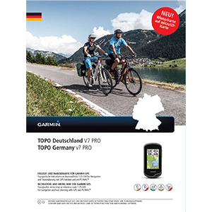
TOPO Germany v7 PRO

TOPO Germany v7 PRO
TOPO Deutschland V7 PRO
Part Number: 010-11288-04 (DVD & MicroSD/SD)

Image

Let us guide you on all of your recreational and outdoor adventures in Germany, from the shores of the North Sea up to the summits of the Alps.

  • Provides accurate topographic maps in reference scale of 1:25,000.
  • offers an enhanced recreational trail network, including detailed hiking trails for touristic regions and long-distance hiking trails (national level).
  • Displays ...
Read more : TOPO Germany v7 PRO | Views : 13956 | Replies : 7


City Navigator North America NT 2015.40

City Navigator North America NT 2015.40


FID:3692


Map Source Data:
Locked: Part1 | Part2 | Part3 | Part4 | Part5
Or Mirror Part1 | Part2 | Part3 | Part4 | Part5

UnLocked: Part1 | Part2 | Part3 | Part4 | Part5
Or Mirror Part1 | Part2 | Part3 | Part4 | Part5


Image ALL:
Locked: Part1 | Part2 | Part3 | Part4
Or Mirror Part1 | Part2 | Part3 | Part4

UnLocked: Part1 | Part2 ...
Read more : City Navigator North America NT 2015.40 | Views : 12823 | Replies : 9


BlueChart g2 - HAF001R - Eastern Africa 2014.5 (16.00)

BlueChart g2 - HAF001R - Eastern Africa 2014.5 (16.00)

See your vessel’s precise, on-chart position in relation to navaids, coastal features, anchorages, obstructions, waterways, restricted areas and more with this detailed marine mapping data.
  • Shaded depth contours, coastlines, spot soundings, navaids, port plans, wrecks, obstructions, intertidal zones, restricted areas and IALA symbols.
  • Seamless transitions between zoom levels and more continuity across chart boundaries.
  • Standard 2-D direct overhead or 3-D “over the bow” ...
Read more : BlueChart g2 - HAF001R - Eastern Africa 2014.5 (16.00) | Views : 2312 | Replies : 3


Request: Garmin GB Discoverer Premium 1:25k

Hello,

"Garmin GB Discoverer Premium is the most detailed full coverage recreational map for Great Britain yet. It includes the 1:25,000, 1:50,000 and 1:250,000 scale mapping from Ordnance Survey Great Britain, covering the whole region on just one microSD/SD card."

Any chance to point me in to the right direction or upload above ? https://buy.garmin.com/en-GB/GB/prod168575.html

Thanks in advance,
n1
Read more : Request: Garmin GB Discoverer Premium 1:25k | Views : 3801 | Replies : 2


(request)TOPO France Montagne PRO

good morning


I search "TOPO France Montagne PRO"


thank you
Read more : (request)TOPO France Montagne PRO | Views : 15815 | Replies : 31


City Navigator Russia NT 2016.10 HERE

City Navigator Russia NT 2016.10 HERE

Navigate the streets with confidence. This product provides detailed road maps and points of interest for your device, so you can navigate with exact, turn-by-turn directions to any address or intersection.
  • Displays roads and names in the Cyrillic alphabet (not available in English).
  • Includes millions of roads, including motorways, national and regional thoroughfares and local roads.
  • Displays thousands of points of interest throughout the country, including ...
Read more : City Navigator Russia NT 2016.10 HERE | Views : 3647 | Replies : 3


Login  •  Register


Statistics

Total posts 166133 • Total topics 17546 • Total members 689709