It is currently Sun Nov 02, 2025 9:46 pm

News News of New Maps

Site map of New Maps » Forum : New Maps

Garmin TOPO Austria v3

TOPO Austria v3
Version: 3.00
Released: June, 2012
Part Number: (Download) 010-D1199-00 , (DVD & microSD Card) 010-11289-01

Let us be your outdoor guide to paths, trails, shelters, lakes, mountains and more in Austria. With 1:25,000 scale topographic mapping, this product is fully loaded with new features, so whether out for a hike or a climbing tour, TOPO Austria v3 will get you where you need to go.
Features:
  • Offers countrywide coverage on a ...
Read more : Garmin TOPO Austria v3 | Views : 9984 | Replies : 11


Malfreemaps 2012.20 (Malaysia/Singapore/Brunei NT)

Malfreemaps 2012.20 (Malaysia/Singapore/Brunei NT)

Code: Select all
nüvi 3790V / 3790
[url]http://download.garmin.com/sg/download/MapUpgrade/201220/malfree_201220_3790.exe[/url]

nüvi 2575RLM / 2565LM / 2465LM / 50LM / 40LM / 2575R / 2565 / 2465 / 1460 / 1350 Series / 765 / 760 / 255W
[url]http://download.garmin.com/sg/download/MapUpgrade/201220/malfree_201220_255.exe[/url]

nüvi 1250
[url]http://download.garmin.com/sg/download/MapUpgrade/201220/malfree_201220_1250.exe[/url]

nuvi 205 / 205W / GMXT / GMPC
[url]http://download.garmin.com/sg/download/MapUpgrade/201220/malfree_201220_205.exe[/url]


Code:
File: gmapsupp.img, length 55316480
Header: 29.06.2012 14:02:29, DSKIMG, XOR 00, V 12.20, Ms 0, D381400BG023
Mapset: MFM 2012.20

Data MPS
V: Malaysia 2, ...
Read more : Malfreemaps 2012.20 (Malaysia/Singapore/Brunei NT) | Views : 3331 | Replies : 0


Taiwan City Navigator 2012.20

Taiwan City Navigator 2012.20


Nuvi 765:
344.60MB contains Mapsource Taiwan 2012.20, Taiwan Map 2012.20, Taiwan Address Point 2012.20, 3D Buildings 2012.20 and Junction View Standard

[url]http://download.garmin.com/tw/download/MapUpgrade/TWN_CN_2012_20/W1/201220Type01.exe[/url]

Nuvi 760
335.91MB contains Mapsource Taiwan 2012.20, Taiwan Map 2012.20, Taiwan Address Point 2012.20 and Junction View Standard

[url]http://download.garmin.com/tw/download/MapUpgrade/TWN_CN_2012_20/W1/201220Type02.exe[/url]

Nuvi 255W/265
167.45MB

[url]http://download.garmin.com/tw/download/MapUpgrade/TWN_CN_2012_20/W1/201220Type03.exe[/url]

Nuvi 5000
834.47MB contains Mapsource Taiwan 2012.20, Taiwan Map 2012.20, Taiwan Address Point 2012.20 and Junction View Deluxe

[url]http://download.garmin.com/tw/download/MapUpgrade/TWN_CN_2012_20/W1/201220Type04.exe[/url]

Garmin MobileXT
166.62MB contains Mapsource Taiwan 2012.20 ...
Read more : Taiwan City Navigator 2012.20 | Views : 2303 | Replies : 0


Garmin City Navigator Singapore/Malaysia NT 2012.20

(FID 2714)


Code: Select all
Nuvi 3790/3790V: (724MB)

[url]http://download.garmin.com/sg/download/MapUpgrade/201220/201220_type1.exe[/url]


Nuvi 205/Nuvi 205W: (65MB)

[url]http://download.garmin.com/sg/download/MapUpgrade/201220/201220_type2.exe[/url]


Nuvi 1250: (284MB)

[url]http://download.garmin.com/sg/download/MapUpgrade/201220/201220_type3.exe[/url]


Nuvi 50LM/40LM/1460/1350/765/760/255W: (321MB)

[url]http://download.garmin.com/sg/download/MapUpgrade/201220/201220_type4.exe[/url]


Nuvi 2575RLM/2565LM/2465LM/2575R/2565/2465: (363MB)

[url]http://download.garmin.com/sg/download/MapUpgrade/201220/201220_type5.exe[/url]


Thanks to plyy
Read more : Garmin City Navigator Singapore/Malaysia NT 2012.20 | Views : 4071 | Replies : 2


BlueChart G2 - Seamaps Europe

HEU718L - Mediterranean Sea v2011.5 (v13.00)
Version: 2011.5
Released: Aug, 2011
Credit to Ballebar

Features
Detailed offshore coastal coverage of the Mediterranean Sea in its entirety. Coverage features the Strait of Gibraltar, the Balearic Islands, the French Riviera, Corsica, Sardinia, Sicily, the Adriatic Sea, the Greek Islands, the Aegean Sea, the Dardanelles and Bosporus Straits, the Sea of Marmara, Cyprus, the Suez Canal, Tripoli and Algiers Harbors, and the Gulfs of Gabès and Tunisia.

Coverage ...
Read more : BlueChart G2 - Seamaps Europe | Views : 9312 | Replies : 10


U.S. Inland Lakes Vision - Northeast v7.00

Version: 7.00
Released: Apr, 2011

Features

Displays detailed shorelines, shaded depth contours, coastlines, streams, channels, boat ramps, fuel stations, marinas, campgrounds and fishing locations (where available)
Includes:
High resolution satellite imagery (selected lakes only¹), providing you with unparalleled situational awareness
MarinerEye view (selected lakes only¹), showing your surroundings in 3-D so you can gauge your position quickly and reliably
FishEye view (selected lakes only¹), showing your surroundings below the waterline in 3-D, including bathymetric detail ...
Read more : U.S. Inland Lakes Vision - Northeast v7.00 | Views : 3003 | Replies : 0


Roads of Armenia NT 2009 v.1.05

Image


info
Code: Select all
http://gpsarmenia.com/?pg=maps


Roads of Armenia NT" v1.50
Date of release: 2009 -- Version: v.1.05
Language: English
FID: 1424
Description: detailed map of Yerevan , Gyumri, Vanadzor, etc.


Code: Select all
lock
[url]http://www.mirrorcreator.com/files/HP42IWEK/ROAD_OF_ARMENIA_L.rar_links[/url]
unlock
[url]http://www.mirrorcreator.com/files/I2OQJLDS/ROAD_OF_ARMENIA_U.rar_links[/url]


Thanks to Caty
Read more : Roads of Armenia NT 2009 v.1.05 | Views : 3114 | Replies : 0


TOPO Alpina Espana

TOPO Alpina Espana - Sistema Central - Picos v2.00

Image


info
Code: Select all
https://buy.garmin.com/shop/shop.do?cID=255&pID=90075


Version: 2.00
Released: Jan, 2011
Part Number: 010-D0982-00 (Download)

Version: 2.00
Released: March, 2011
Part Number: 010-11656-00 (microSD™/SD™ Card)


Explore some of Spain's most admired mountain ranges with TOPO Alpina Espana, the perfect guide for recreational and outdoor activities throughout the Sistema Central-Picos region. The region includes raster maps for Picos de Europa, Sierra de Gredos, Sierra de Guadarrama and La Pedriza. Travel ...
Read more : TOPO Alpina Espana | Views : 13411 | Replies : 23


BlueChart g2: HPC024R - Australia & New Zealand v2012 (v13.5

info

Code: Select all
https://buy.garmin.com/shop/shop.do?pID=51201&pvID=38854


Version: 2012
Released: Feb, 2012
Part Number: 010-C1020-20

Features

Includes realistic navigation features showing everything from shaded depth contours and coastlines to spot soundings, navaids, port plans, wrecks, obstructions, intertidal zones, restricted areas, IALA symbols and more.
Features smooth displays, including seamless transitions between zoom levels and more continuity across chart boundaries.
Allows users to choose between standard 2-D direct overhead or 3-D "over the bow" map perspective to make chart reading and ...
Read more : BlueChart g2: HPC024R - Australia & New Zealand v2012 (v13.5 | Views : 2316 | Replies : 0


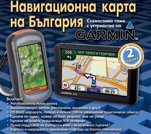
Bulgaria OFRM Geotrade Q3 2012 City/Topo-Cyr/Lat

Image

To be able to easily determine if the installed card OFRM Geotrade in your device is updated, changed version numbering and hence instead of serial numbers, versions will be designated by year and quarter, in line with already established international practice, the four annual quarters will be denoted by Q1, Q2, Q3 and Q4. In this respect the new version of the map OFRM Geotrade, designed for the third quarter of this year numbered ...
Read more : Bulgaria OFRM Geotrade Q3 2012 City/Topo-Cyr/Lat | Views : 3015 | Replies : 1


Login  •  Register


Statistics

Total posts 166106 • Total topics 17544 • Total members 689589