In igo8. You know when you are on a long stretch of road and the map goes to aerial. How do i turn that off? I see in settings/navigation i have automatic overview. Is un ticking that good enough?
Cheers
It is currently Sat Nov 29, 2025 10:48 am
 News of NaviTotal.com
Site map of NaviTotal.com » Forum : NaviTotal.com
NaviTotal.com is a community where you can find all needed for your GPSAerialView
Read more : AerialView | Views : 1328 | Replies : 4 | Forum : General Discussions about iGO core
Russia HERE (Navteq) 2013.Q4
Russia HERE (Navteq) 2013.Q4 (fbl, fda, fjv, fpa, fsp, ph, poi, 3dc, 3dl)
fbl+fda
fpa, fsp, fjv, ph, poi, 3dl, 3dc
Password: www.navitotal.com
DEM (Digital Elevation Model, 3D Terrain) file for Russia can be found here.
Found dead links? read ->>HERE<<-
fbl+fda
- Hidden Content
- This board requires you to be registered and logged-in to view hidden content.
fpa, fsp, fjv, ph, poi, 3dl, 3dc
- Hidden Content
- This board requires you to be registered and logged-in to view hidden content.
Password: www.navitotal.com
DEM (Digital Elevation Model, 3D Terrain) file for Russia can be found here.
Found dead links? read ->>HERE<<-
Read more : Russia HERE (Navteq) 2013.Q4 | Views : 3872 | Replies : 0 | Forum : Maps, buildings, dem, POI
Maps v9.25 broken links (no maps on ff.com)
Hi All.
Haven't been here for a while.
First of all, thanks for you continuous support for a couple of last years!
I try to download some v9.25 maps and it seems to be some broken links. Maps does not exist on ff.com.
Europe v9.25.5412 (w/o activator)
UK&ROI v9.25.5412 (w/o activator).
Are you able to assist?
Much appreciate! :)
Hi again
Sorry, It's not Europe v9.25.5412. It ...
Read more : Maps v9.25 broken links (no maps on ff.com) | Views : 2270 | Replies : 4 | Forum : General Discussions about TomTom
Turkey HERE (Navteq) 2013.Q4
Turkey HERE (Navteq) 2013.Q4 (fbl, fda, fpa, fsp, ftr, poi, fjw*)
Password: www.navitotal.com
*fjw (junction view) is working only with some new becker models.
DEM (Digital Elevation Model, 3D Terrain) files can be found here.
Found dead links? read ->>HERE<<-
- Hidden Content
- This board requires you to be registered and logged-in to view hidden content.
Password: www.navitotal.com
*fjw (junction view) is working only with some new becker models.
DEM (Digital Elevation Model, 3D Terrain) files can be found here.
Found dead links? read ->>HERE<<-
Read more : Turkey HERE (Navteq) 2013.Q4 | Views : 3872 | Replies : 1 | Forum : Maps, buildings, dem, POI
Newbie and totally confused
Hi Guys,
I am totally new to this forum and the concept of sat nav's etc etc.
I have looked through many posts on here, other forums and via google to help understand what I have to do to get iGo Primo 2.4 running on my Eonon 5150 which runs Win CE as far as I know.
Each post is either too difficult to interpret with all the coding or has loads of dead links ...
Read more : Newbie and totally confused | Views : 3050 | Replies : 4 | Forum : General Discussions about iGO core
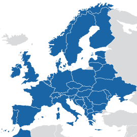
Europe HERE (Navteq) 2013.Q4
Europe HERE (Navteq) 2013.Q4 (fbl, fda, fpa, fsp, ftr, hnr, ph, poi, Ext poi, 3dc, 3dl)
Torrent magnet:
Direct download:
Buildings:
3dc:
Austria, Belgium, Bulgaria, Croatia, Czech Republic, Denmark, Estonia, Finland, France, Germany, Greece, Hungary, Ireland, Italy, Latvia, Lithuania, Luxembourg, Netherlands, Norway, Poland, Portugal, Romania, Slovakia, Slovenia, Spain, Sweden, Switzerland, Ukraine, United Kingdom
3dl:
Austria, Belgium, Bosnia Herzegovina, Bulgaria, Croatia, Czech Republic, Denmark, Estonia, Finland, France, Germany, Greece, Hungary, Ireland, Italy, Kosovo, Latvia, ...
Torrent magnet:
- Hidden Content
- This board requires you to be registered and logged-in to view hidden content.
Direct download:
Buildings:
3dc:
Austria, Belgium, Bulgaria, Croatia, Czech Republic, Denmark, Estonia, Finland, France, Germany, Greece, Hungary, Ireland, Italy, Latvia, Lithuania, Luxembourg, Netherlands, Norway, Poland, Portugal, Romania, Slovakia, Slovenia, Spain, Sweden, Switzerland, Ukraine, United Kingdom
3dl:
Austria, Belgium, Bosnia Herzegovina, Bulgaria, Croatia, Czech Republic, Denmark, Estonia, Finland, France, Germany, Greece, Hungary, Ireland, Italy, Kosovo, Latvia, ...
Read more : Europe HERE (Navteq) 2013.Q4 | Views : 16909 | Replies : 2 | Forum : Maps, buildings, dem, POI
Need help tts android tablet Toshiba 10.1 "
may be you can help me ..... my problem is the following:
1 intallez 1.3.2.APK EUROPE TOMTOM on my tablet Toshiba excites write android
2 I access the menu and settings without difficulty
3 I select the voice and everything works fine.
4 In contrast, the map display that does not have the screen? my question is why?
5 And finally there no solution to my problem?
In advance thank you for your have.
Read more : Need help tts android tablet Toshiba 10.1 " | Views : 2282 | Replies : 0 | Forum : Android Discussion
lane guidance
I had a question I have the tomtom map v925.5409 on my TomTom go live 950 but I have a problem. When I set a destination it does not show the lane guidance but it is on in the settings. Is there an solution for it?
Read more : lane guidance | Views : 1978 | Replies : 4 | Forum : General Discussions about TomTom
Citroen WORKING RNEG 2013-2014 MAPS (2013 v2)
Citroen WORKING RNEG 2013-2014 MAPS (2013 v2)
Info
How to Install
To install the SDHC card :
1/ Please have a 16 GB SDHC card for size of 7,75 Go (8 328 351 744 bytes) that most of 8 GB cards not accepted.
2/ The format in fat32, file allocation size : 64KB.
3/ If necessary (can be dispensed), rename it to: FC30-3DA9 (the serial number of the card, not the name of ...
Read more : Citroen WORKING RNEG 2013-2014 MAPS (2013 v2) | Views : 17809 | Replies : 5 | Forum : Peugeot/Citroen
AutoMapa Win Europe 6.15 1404 Final Multilingual
AutoMapa Win Europe 6.15 1404 Final Multilingual

Info
AutoMapa Win Europe 6.15 1404 Final Multilingual | 3.38 GB
AutoMapa - represents himself, a peculiar and quite advanced in circles GPS navigation software , this product has already won the hearts of many Polish motorists are increasingly resorting to a route using the GPS navigation devices . Program many different useful , and most importantly the necessary functions for a successful follow- up to ...
Read more : AutoMapa Win Europe 6.15 1404 Final Multilingual | Views : 3544 | Replies : 1 | Forum : Other Systems
Last 10 active topics
Statistics
Total posts 166358 • Total topics 17574 • Total members 690854