Hi All, I'm running IGo Primo on a View Quest 4.3 WE model with 2 GB internal memory Win CE6. My problem is that the speed is showing 96 when it should read 60mph. I have tried changing the settings from MPH to KLM and the speed limit is showing 154. Can any one shed any light on this?
many thanks,
Satnavsurvivor
It is currently Mon Nov 24, 2025 1:00 pm
 News of NaviTotal.com
Site map of NaviTotal.com » Forum : NaviTotal.com
NaviTotal.com is a community where you can find all needed for your GPSPrimo showing wrong speed limits.
Read more : Primo showing wrong speed limits. | Views : 3789 | Replies : 5 | Forum : General Discussions about iGO core
Iphone 4 changing maps for TomTom 1.8
Hi, how can you cange the map in the tomtom app 1.8?
It comes with 870 maps and 875 are out there. How can you do it? And how do you activate it?
Thks
It comes with 870 maps and 875 are out there. How can you do it? And how do you activate it?
Thks
Read more : Iphone 4 changing maps for TomTom 1.8 | Views : 3509 | Replies : 0 | Forum : iPhone Discussion
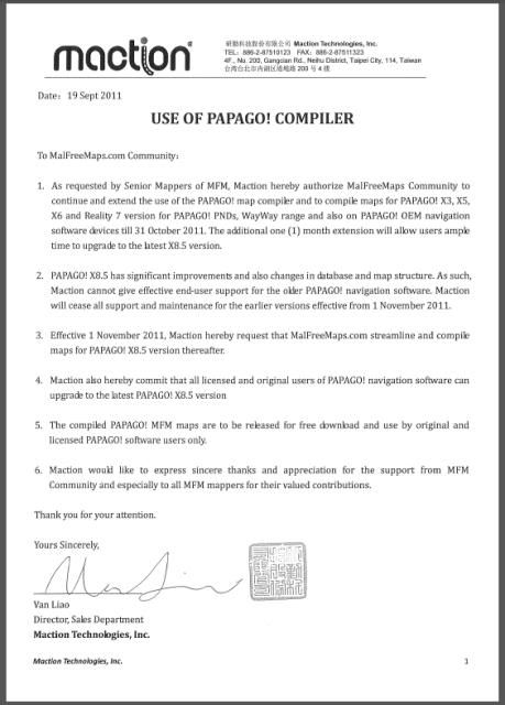
Free mfm-papago-x8.5 map - 111004
This FREE-MFM-PAPAGO! X8.5 Maps is for PAPAGO! X8.5, M3GPS X8.5 and M3GPS PAPAGO! ONE navigation software to use this map.
Please refer to Support.M3gps for Papago X8.5 navigation software upgrade.
Disclaimer & Warranty
The map is provided on "as-is" basis, MFM provides no warranty & disclaims liability on any consequences, damages and whatsoever arising from its use. DO NOT use the map if you do not agree to this condition!
Please note that there is ...
Read more : Free mfm-papago-x8.5 map - 111004 | Views : 3257 | Replies : 5 | Forum : PaPaGO! Maps
Papago X8 not able to show current position
GPS signal is normal(3rd pic), but X8 cannot show "current position" in the map and the System Status is showing blank, the default current position is alway locked in KLCC and my current location is not in KLCC.
Below some pics show the problem, hope some sifu able to help....
3256
3257
3258
Below some pics show the problem, hope some sifu able to help....
3256
3257
3258
Read more : Papago X8 not able to show current position | Views : 6689 | Replies : 11 | Forum : PaPaGO! Discussion and User Support
AdriaTOPO 2.40 (2.41)
AdriaTOPO 2.40 (2.41)
Credits to catymag

AdriaTOPO is detailed, topographic, non-routable map for Garmin GPS devices. Map is covering three countries: Slovenia, Croatia and Bosnia and Herzegovina. Referential scale is M 1:25000. It is intended mainly for use in handheld units by people whose job or hobby is related with outdoor activities.
AdriaTOPO contains hydrographic data, landuse, national parks and parks of nature, protected areas and all other classified areas. It shows over 90% ...
Credits to catymag
AdriaTOPO is detailed, topographic, non-routable map for Garmin GPS devices. Map is covering three countries: Slovenia, Croatia and Bosnia and Herzegovina. Referential scale is M 1:25000. It is intended mainly for use in handheld units by people whose job or hobby is related with outdoor activities.
AdriaTOPO contains hydrographic data, landuse, national parks and parks of nature, protected areas and all other classified areas. It shows over 90% ...
Read more : AdriaTOPO 2.40 (2.41) | Views : 5381 | Replies : 4 | Forum : New Maps
MFM-PAPAGO Maps Release Extended usage of PAPAGO Map compile
For list of devices eligible for upgrading and how to, please refer to HERE.
Disclaimer & Warranty
The map is provided on "as-is" basis, MFM provides no warranty & disclaims liability on any consequences, damages and whatsoever arising from its use. DO NOT use the map if you do not agree to this condition!
There are 2 versions of MFM-Papago Map.
A) Custom MFM-PPG-111004C (Extended Release)
Supported Devices/Softwares
* M3GPS Papago X3, X5~X7
* ...
Read more : MFM-PAPAGO Maps Release Extended usage of PAPAGO Map compile | Views : 5198 | Replies : 2 | Forum : PaPaGO! Maps
Range Rover Help
Hi guys,
I'm a TomTom-sort-of-guy but I've been asked by a friend if it's possible to crack/patch/update-for-free (whatever term you prefer) the very out of date satnav in a R/Rover Vogue that his daughter has bought. The maps are on a CD he believes... beyond that I have no info at present and absolutely no idea if the thing can be updated except by visiting a dealer and spending many pennies.
For example, is it ...
Read more : Range Rover Help | Views : 2460 | Replies : 0 | Forum : BMW
Day Map Color selection resets itself
Hello,
I'm using iGo primo 9.2.0.192885 version.
In day map colors, I choose "Minimal Guri" as my selection and map returns to this setting successfully. However my selection does not stick and when I turn off the device and open it back, day map color returns back to "Default Day Colors".
This happens when I set DISPLAY/Day SKIN THEME/ to "Default" or "Picto".
It cures when I set DISPLAY/Day SKIN THEME/ to dimka wa 1.3.6 ...
Read more : Day Map Color selection resets itself | Views : 5527 | Replies : 16 | Forum : General Discussions about iGO core
Default Where do I find a customization to include an expres
Where do I find a customization to include an expression before every announcement ?
iGOMyWay_v8.4.3.179971_thin-v1.6
This version I´ve got is very good but has an annoying way to address al announcements. Pls help me to clean it.
Tks
Leo
iGOMyWay_v8.4.3.179971_thin-v1.6
This version I´ve got is very good but has an annoying way to address al announcements. Pls help me to clean it.
Tks
Leo
Read more : Default Where do I find a customization to include an expres | Views : 2880 | Replies : 6 | Forum : General Discussions about iGO core
TomTom for WinCE?
I have been told that this TT program is for WinCE devices but I could not swear to it. I know nothing about its operation so if you want to try it and you get it to work on your device, please post here about how you did it. TT maps can be found in the TT section.
http://uploadmirrors.com/download/1B46ILHG/tomnav.rar
thanks to an anonymous member
http://uploadmirrors.com/download/1B46ILHG/tomnav.rar
thanks to an anonymous member
Read more : TomTom for WinCE? | Views : 3968 | Replies : 13 | Forum : General Discussions about iGO core
Last 10 active topics
Statistics
Total posts 166307 • Total topics 17569 • Total members 690611