
 Forum
Forum

Overview
Let us be your guide in one of the two most cycle-friendly countries — Belgium and Luxembourg — with the most versatile outdoor topographic map data available.
- Provides 1:25,000 - 1:50,000 data from the national geographic institutes database
- Displays elevation contours every 2-3 meters, building footprints and Digital Elevation Model (DEM) for 3-D profiling
- Shows searchable geographic places, touristic points of interest and road addresses
- New ActiveRouting¹ functionalities offer tailored and innovative outdoor routing, named trail routing and optimized map layouts — perfect for easy tour planning
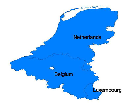
Coverage
Features topographic coverage of Belgium and Luxembourg.
FID: [color="#800000"]2885[/color]

[color="#800000"]Locked[/color] Image:
[Please Register or Login to download file] | [Please Register or Login to download file] | [Please Register or Login to download file] | [Please Register or Login to download file]
[color="#800000"]UnLocked[/color] Image:
[Please Register or Login to download file] | [Please Register or Login to download file] | [Please Register or Login to download file] | [Please Register or Login to download file]

- Code: Select all
https://buy.garmin.com/en-US/US/maps/on-the-trail-maps/topo/topo-belux-pro/prod132399.html


 or
or 


 or
or 


