Garmin VUS003R Cape Cod BlueChart g2 Vision (v11.50)
Fri Jan 28, 2011 1:17 pm
[SIZE="4"]Garmin VUS003R Cape Cod BlueChart g2 Vision (v11.50)[/size]
Get a fresh perspective when you take to the water with BlueChart® g2 Vision®. With BlueChart g2 Vision data, you’ll get detailed marine cartography that provides convenient viewing of nautical content and other premium features. BlueChart g2 Vision allows you to see your vessel’s precise, on-chart position in relation to navaids, coastal features, anchorages, obstructions, waterways, restricted areas and more. You will also have access to detailed mapping capabilities that include Safety Shading¹, Fishing Charts¹, smooth data transition between zoom levels, harmonious transition across chart borders, and reduction of chart discontinuities. Premium features include 3-D perspective above and below the waterline, Auto Guidance, high-resolution imagery, and “real picture” aerial photos of ports, harbors, marinas, waterways, landmarks and other points of interest. It’s the most realistic mapping display Garmin has ever offered
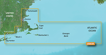
Gloucester through New London, including Narragansett Bay, Block Island, Martha's Vineyard, Nantucket Island, the entire Cape, and includes general coverage Georges Bank
PID 1, FID 2023, region 1,14
[SIZE="3"][Please Register or Login to download file] [/size] (453,3 MB)
[SIZE="3"][Please Register or Login to download file] [/size] (286,1 MB)
Thanks to a nice friend who provided it
Get a fresh perspective when you take to the water with BlueChart® g2 Vision®. With BlueChart g2 Vision data, you’ll get detailed marine cartography that provides convenient viewing of nautical content and other premium features. BlueChart g2 Vision allows you to see your vessel’s precise, on-chart position in relation to navaids, coastal features, anchorages, obstructions, waterways, restricted areas and more. You will also have access to detailed mapping capabilities that include Safety Shading¹, Fishing Charts¹, smooth data transition between zoom levels, harmonious transition across chart borders, and reduction of chart discontinuities. Premium features include 3-D perspective above and below the waterline, Auto Guidance, high-resolution imagery, and “real picture” aerial photos of ports, harbors, marinas, waterways, landmarks and other points of interest. It’s the most realistic mapping display Garmin has ever offered
- Realistic navigation features showing everything from shaded depth contours and coastlines to spot soundings, navaids, port plans, wrecks, obstructions, intertidal zones, restricted areas, IALA symbols and more.
- Smooth display presentation including seamless transitioning between zoom levels and more continuity across chart boundaries.
- Safety shading¹ allows user to enable contour shading for all depth contours shallower than user-defined safe depth.
- Fishing charts¹ to help scope out bottom contours and depth soundings with less visual clutter on the display.
- High-resolution satellite imagery, when overlaid on the chart, provides the mariner with a realistic view of the land and water for unparalleled situational awareness.
- Aerial reference photography provides "real world" photos of ports, harbors, marinas, waterways, navigation landmarks and other points of interest, offering the mariner another powerful tool for navigating unfamiliar waters.
- MarinerEye view 3-D perspective provides a bird's eye view from behind the boat showing the chart information for a quick, reliable and easy position fix.
- FishEye view 3-D perspective provides an underwater view that visually represents the sea floor according to the chart's information.
- Auto Guidance technology searches chart data to suggest the best passage to a destination. Includes tides, currents, marine services, coastal roads and points of interest.
- Compatible with HomePort™ — software that lets you use BlueChart data to conveniently plan and organize routes from your computer before your trip.
Gloucester through New London, including Narragansett Bay, Block Island, Martha's Vineyard, Nantucket Island, the entire Cape, and includes general coverage Georges Bank
PID 1, FID 2023, region 1,14
[SIZE="3"][Please Register or Login to download file] [/size] (453,3 MB)
[SIZE="3"][Please Register or Login to download file] [/size] (286,1 MB)
Thanks to a nice friend who provided it
Re: Garmin VUS003R Cape Cod BlueChart g2 Vision (v11.50)
Fri Mar 27, 2020 12:16 am
I can't download the file i keep getting an error message saying:
This site can’t be reachedwww.multiupload.com refused to connect.
Try:
Checking the connection
Checking the proxy and the firewall
ERR_CONNECTION_REFUSED
This site can’t be reachedwww.multiupload.com refused to connect.
Try:
Checking the connection
Checking the proxy and the firewall
ERR_CONNECTION_REFUSED