Garmin Slovakia TOPO v4
Sun Dec 09, 2012 8:02 pm
Garmin Slovakia TOPO v4
Requirements: for all Garmin Devices
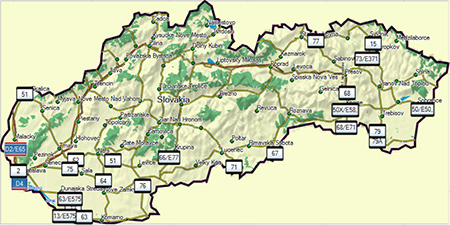
Overview:Provides digital topographic maps, with routing on hiking and cycling trails
•Displays more than 60,000 searchable points of interests, such as marked tourist and cyclist trails, names of hills with altitudes, hotels, gas stations and more
•Contains full coverage of road and street networks, including more than 20,000 km (12,400 mi) of hiking paths and cycling trails
•Shows Digital Elevation Model (DEM) and contour lines with 25 m (82 ft) intervals to help you visualize your trip
•Displays rivers, lakes, railways, national parks, protected areas and more-

More Info:
Download Instructions:
[Please Register or Login to download file] or [Please Register or Login to download file]
MapID: 5015
password: ozboss18
inside
unlocked image
hoster
netload.in
share-online.biz
Requirements: for all Garmin Devices
Overview:Provides digital topographic maps, with routing on hiking and cycling trails
•Displays more than 60,000 searchable points of interests, such as marked tourist and cyclist trails, names of hills with altitudes, hotels, gas stations and more
•Contains full coverage of road and street networks, including more than 20,000 km (12,400 mi) of hiking paths and cycling trails
•Shows Digital Elevation Model (DEM) and contour lines with 25 m (82 ft) intervals to help you visualize your trip
•Displays rivers, lakes, railways, national parks, protected areas and more-
More Info:
- Code:
https://buy.garmin.com/shop/shop.do?pID=129409
Download Instructions:
[Please Register or Login to download file]
or [Please Register or Login to download file] MapID: 5015
password: ozboss18
inside
unlocked image
hoster
netload.in
share-online.biz
Mon Dec 10, 2012 8:28 am
Slovakia TOPO v4
Version: 4.00
Released: Sept, 2012
Part Number: 010-11795-01
Outdoor enthusiasts: your adventure is waiting. Explore numerous national parks and preserves in Slovakia with topographic map data for your Garmin device. Search thousands of points of interests as well as hundreds of miles of hiking and cycling trails.
Features digital topographic maps for Slovakia
[tr]
[td][Please Register or Login to download file] [/td]
[td]
[Please Register or Login to download file]
FID: 5015[/color][/td][/tr]
Version: 4.00
Released: Sept, 2012
Part Number: 010-11795-01
Outdoor enthusiasts: your adventure is waiting. Explore numerous national parks and preserves in Slovakia with topographic map data for your Garmin device. Search thousands of points of interests as well as hundreds of miles of hiking and cycling trails.
- Provides digital topographic maps, with routing on hiking and cycling trails
- Displays more than 60,000 searchable points of interests, such as marked tourist and cyclist trails, names of hills with altitudes, hotels, gas stations and more
- Contains full coverage of road and street networks, including more than 20,000 km (12,400 mi) of hiking paths and cycling trails
- Shows Digital Elevation Model (DEM) and contour lines with 25 m (82 ft) intervals to help you visualize your trip
- Displays rivers, lakes, railways, national parks, protected areas and more
Features digital topographic maps for Slovakia
[tr]
[td][Please Register or Login to download file] [/td]
[td]
[Please Register or Login to download file]
FID: 5015[/color][/td][/tr]
- Code:
https://buy.garmin.com/shop/shop.do?pID=129409
Re: Garmin Slovakia TOPO v4
Mon Jun 06, 2022 12:38 pm
Hi,
have someone new functional link for this map please?
Thanks in advance…
have someone new functional link for this map please?
Thanks in advance…
Re: Garmin Slovakia TOPO v4
Mon Jun 06, 2022 4:49 pm
Garmin Slovakia Topo v 4 - Unlocked IMG
GMapTool Info:
GMapTool Info:
Spoiler: Show
- Hidden Content
- This board requires you to be registered and logged-in to view hidden content.