Garmin Hangneigungskarte (slope inclination map)
Tue Mar 10, 2015 3:07 pm
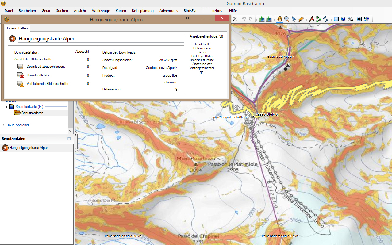
Garmin Hangneigungskarte (slope inclination map)
Requirements: for all Garmin Devices hows supported birdseye
Overview: From now on you can for all our winter trips already see on the map how steep the terrain is where your moves you! This feature is unique on the web and completely free of charge.
This so-called "slope Layer" shows you the first time coverage for almost the entire Alpine region, whether the site has more than 30 ° inclination. All surfaces which appear colored red on the map, exhibit 30 ° slope, or more.
More Info:
Download Instructions:
inside:
jnx file
copy file to birdseye folder on device
or an USB Stick to:\\Garmin\birdseye and BaseCamp see map
hoster
filefactory.com
share-online.biz
Requirements: for all Garmin Devices hows supported birdseye
Overview: From now on you can for all our winter trips already see on the map how steep the terrain is where your moves you! This feature is unique on the web and completely free of charge.
This so-called "slope Layer" shows you the first time coverage for almost the entire Alpine region, whether the site has more than 30 ° inclination. All surfaces which appear colored red on the map, exhibit 30 ° slope, or more.
More Info:
- Code:
http://blog.outdooractive.com/de/2009/01/28/neu-bei-outdooractivecom-der-hangneigungslayer-bei-ski-und-schneeschuhtouren/
Download Instructions:
- Hidden Content
- This board requires you to be registered and logged-in to view hidden content.
inside:
jnx file
copy file to birdseye folder on device
or an USB Stick to:\\Garmin\birdseye and BaseCamp see map
hoster
filefactory.com
share-online.biz
Re: Garmin Hangneigungskarte (slope inclination map)
Thu Jan 26, 2023 10:38 am
is this map still available anywhere? Links (2015) no longer work
Thanks!!#
N.T
ist diese Karte noch irgendwo verfügbar? Links (2015) funktionieren nicht mehr
Danke!!#
NT
Thanks!!#
N.T
ist diese Karte noch irgendwo verfügbar? Links (2015) funktionieren nicht mehr
Danke!!#
NT
Last edited by GarminNuvi on Thu Jan 26, 2023 9:27 pm, edited 1 time in total.
Reason: Welcome this is an English language forum. Translate first & last time.
Reason: Welcome this is an English language forum. Translate first & last time.
Re: Garmin Hangneigungskarte (slope inclination map)
Thu Jan 26, 2023 9:43 pm
Re: Garmin Hangneigungskarte (slope inclination map)
Wed Feb 15, 2023 3:08 pm
well,
I need it on my Garmin device (or Basecamp) this format is not supported by openslope
I need it on my Garmin device (or Basecamp) this format is not supported by openslope