Garmin Hangneigungskarte (slope inclination map)   

Garmin Hangneigungskarte (slope inclination map)

Postby ozboss » Tue Mar 10, 2015 3:07 pm

Garmin Hangneigungskarte (slope inclination map)
Requirements: for all Garmin Devices hows supported birdseye
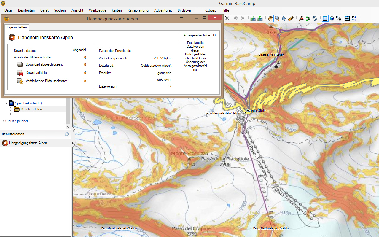
Overview: From now on you can for all our winter trips already see on the map how steep the terrain is where your moves you! This feature is unique on the web and completely free of charge.
This so-called "slope Layer" shows you the first time coverage for almost the entire Alpine region, whether the site has more than 30 ° inclination. All surfaces which appear colored red on the map, exhibit 30 ° slope, or more.

Image


More Info:
Code: Select all
http://blog.outdooractive.com/de/2009/01/28/neu-bei-outdooractivecom-der-hangneigungslayer-bei-ski-und-schneeschuhtouren/

Download Instructions:
This board requires you to be registered and logged-in to view hidden content.


inside:
jnx file

copy file to birdseye folder on device
or an USB Stick to:\\Garmin\birdseye and BaseCamp see map

hoster
filefactory.com
share-online.biz
ozboss offline


User avatar Ex Moderator


Joined: Mon Dec 28, 2009 3:42 pm
Posts: 336
Has thanked: 0 time
Been thanked: 372 times

Re: Garmin Hangneigungskarte (slope inclination map)

Postby orientierungslos66 » Thu Jan 26, 2023 10:38 am

is this map still available anywhere? Links (2015) no longer work
Thanks!!#
N.T

ist diese Karte noch irgendwo verfügbar? Links (2015) funktionieren nicht mehr
Danke!!#
NT
Last edited by GarmanNuvi on Thu Jan 26, 2023 9:27 pm, edited 1 time in total.
Reason: Welcome this is an English language forum. Translate first & last time.
orientierungslos66 offline


Junior Member


Joined: Wed Jan 25, 2023 1:05 pm
Posts: 2
Has thanked: 0 time
Been thanked: 0 time

Re: Garmin Hangneigungskarte (slope inclination map)

Postby GarmanNuvi » Thu Jan 26, 2023 9:43 pm

orientierungslos66 wrote:is this map still available anywhere? Links (2015) no longer work
Thanks!!#
N.T

If no one still has a copy take a look at
[Please Register or Login to download file]
Before you post, "The archive is corrupt or damaged"
Please make sure your archive software is up to date or just Use the latest [Please Register or Login to download file]
GarmanNuvi offline


User avatar Moderator


Joined: Tue May 16, 2017 5:19 am
Posts: 1835
Location: On the move
Has thanked: 151 times
Been thanked: 3783 times

Re: Garmin Hangneigungskarte (slope inclination map)

Postby orientierungslos66 » Wed Feb 15, 2023 3:08 pm

well,
I need it on my Garmin device (or Basecamp) this format is not supported by openslope
orientierungslos66 offline


Junior Member


Joined: Wed Jan 25, 2023 1:05 pm
Posts: 2
Has thanked: 0 time
Been thanked: 0 time


Return to New Maps


  • Related topics
    Replies
    Views
    Last post

Who is online

Users browsing this forum: Chriseyo2000 and 4 guests