City Navigator North America 2026.20 FID 12960
Mon Jun 30, 2025 6:36 am
City Navigator North America 2026.20 Unlocked
[Please Register or Login to download file]
[Please Register or Login to download file]
- Hidden Content
- This board requires you to be registered and logged-in to view hidden content.
Last edited by GarminNuvi on Wed Jul 02, 2025 5:23 am, edited 11 times in total.
Reason: Fixed links
Reason: Fixed links
Re: City Navigator North America 2026.20 FID 12960
Wed Jul 02, 2025 5:07 am
- Hidden Content
- This board requires you to be registered and logged-in to view hidden content.
- Hidden Content
- This board requires you to be registered and logged-in to view hidden content.
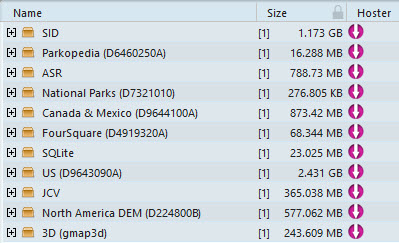
Unlocked gmap folder extract and copy to C:\ProgramData\Garmin\Maps
- Hidden Content
- This board requires you to be registered and logged-in to view hidden content.
- Hidden Content
- This board requires you to be registered and logged-in to view hidden content.
Regional maps for devices with a 2Gb file size limit
Fri Jul 04, 2025 2:44 am
[Please Register or Login to download file]
[Please Register or Login to download file]
[Please Register or Login to download file]
- Hidden Content
- This board requires you to be registered and logged-in to view hidden content.
[Please Register or Login to download file]
- Hidden Content
- This board requires you to be registered and logged-in to view hidden content.
[Please Register or Login to download file]
- Hidden Content
- This board requires you to be registered and logged-in to view hidden content.
Re: City Navigator North America 2026.20 FID 12960
Sat Jul 05, 2025 11:33 am
Can i use this map for Honda Crv 2019? thanks for your sharing such a great apps
Moderator note
Welcome to the forum, take a look at the Honda section.
honda-acura/
Moderator note
Welcome to the forum, take a look at the Honda section.
honda-acura/
City Navigator Lower 48 US & Canada 2026.20 single file
Sat Jul 19, 2025 11:38 pm
[Please Register or Login to download file]
- Hidden Content
- This board requires you to be registered and logged-in to view hidden content.
Re: City Navigator North America 2026.20 FID 12960
Thu Aug 14, 2025 11:52 am
On Windows 11 I extracted part1 with WinRar, and of course it extracted part2 too. Then I ran CityNavigatorNorthAmericaNT2026.10Update.msi and instead of just installing into Program files it asked me for a folder, defaulting to the root of whatever drive I have with the largest free space. Garmin, that is sooo effing not how you do Windows installs.
So I made a C:\GPS folder and directed it there. It went through the install and when done the C:\GPS folder is empty. There's no highlight in the start menu for a new app, nor is there a new desktop shortcut.
Rerunning the msi file offers to remove it. But where is it so I can use it?!
Next thing, I have a Nuvi 1300 and it will only load from SD card, one map img. I named the US map gmapsupp.img and per instructions found all over, the canada and mexico file gmapsupp1.img but it ignores it.
Re: City Navigator North America 2026.20 FID 12960
Thu Aug 14, 2025 7:35 pm
@Galane
Just copy the entire folder City_Navigator_North_America_NT_2026_20.gmap to C:\ProgramData\Garmin\Maps as written above ,then use Mapsource/Mapinstall.
nuvi 13xx,on a FAT 32 Formatted SD card create a folder Map.
Map\gmapsupp.img
Map\gmapsup1.img
If that does not work put Canada & Mexico on the device.
.System\gmapprom.img (CanMex) 1.12 GB
On SD card
Map\gmapsupp.img (US) 3.40 GB
Unlocked gmap folder extract and copy to C:\ProgramData\Garmin\Maps
Just copy the entire folder City_Navigator_North_America_NT_2026_20.gmap to C:\ProgramData\Garmin\Maps as written above ,then use Mapsource/Mapinstall.
nuvi 13xx,on a FAT 32 Formatted SD card create a folder Map.
Map\gmapsupp.img
Map\gmapsup1.img
If that does not work put Canada & Mexico on the device.
.System\gmapprom.img (CanMex) 1.12 GB
On SD card
Map\gmapsupp.img (US) 3.40 GB
Re: City Navigator North America 2026.20 FID 12960
Tue Aug 19, 2025 3:15 pm
I've just upgraded from my 2008 Nuvi 765tfm which used CN Maps which are now discontinued. I have gotten a Drive 66. Which files do I need for this device?
Re: City Navigator North America 2026.20 FID 12960
Tue Aug 19, 2025 9:25 pm
MisterBran wrote:I have gotten a Drive 66. Which files do I need for this
Unfortunately it is NOT able to use or be made to use Unlocked maps.
Your nuvi 765t uses NT maps ,for Europe the last version is 2025.10
map segment for small memory 1490 - north america
Wed Sep 10, 2025 7:27 pm
I have looked into both the github map tools listed on this forum and some up to date open street map images elsewhere.
I have a few older Garmin 1490s models that did have lifetime maps rights when I last used them.
Is it possible with the non-Garmin map tools to carve out just a subset of the whole map for regions I might use these older GPS devices within, and have a smaller map size that could fit within the device's small amount of memory?
I think my more modern LMT devices now get full North America maps from the company/source named "here".
The map tools should let me have the latest map portable on an SD card to use if I take these older "expendable" GPS devices into areas where they might get damaged or lost.
Ideally I'd like to remove the several years old map data from the 1490's old systems for loading map updates and replace it with a small region copied out from the more up to date maps, and hopefully see faster performance and up to date information.
It seems that open street maps gives me more information about natural resources such as the location of streams but I am not sure it is giving me the same quality of information I see for roadways within the commercial maps.
Re: City Navigator North America 2026.20 FID 12960
Thu Sep 11, 2025 3:31 am
robfwd wrote:Is it possible with the non-Garmin map tools to carve out just a subset of the whole map for regions I might use these older GPS devices within, and have a smaller map size that could fit within the device's small amount of memory?
Welcome to the forum,I moved your post to this thread covering the latest N.America maps
Firstly your nuvi 1490 can use the whole of N.America with the use of an SD card, and if it has Lifetime map updates Garmin Express will prompt you.
[Please Register or Login to download file] .
Check out this post above it gives you some options.
If you want to create a custom map set use Mapsource/MapInstall. There are a couple of custom maps sets in this thread that might help.
Re: City Navigator North America 2026.20 FID 12960
Fri Oct 10, 2025 12:02 am
Any JCV files for nuvi 13xx ,14xx ,765 (480x270)?
Re: City Navigator North America 2026.20 FID 12960
Fri Oct 10, 2025 8:43 pm
Re: City Navigator North America 2026.20 FID 12960
Wed Oct 15, 2025 5:41 pm
Am I able to use this map with a zumo 550?
Edit: Just for more information - looking to update North America only.
Edit: Just for more information - looking to update North America only.
Re: City Navigator North America 2026.20 FID 12960
Wed Oct 15, 2025 8:02 pm
humessea wrote:Am I able to use this map with a zumo 550?
Welcome to the forum.
Yes ,using an SD card will be the best option as N.America maps have out grown your storage.
On a 4Gb FAT 32 formatted SD card create a folder Garmin and place the large (3.40 GB) US map in there named gmapsupp.img.
On the device copy the Mexico & Canada small (1.12 GB) in the Garmin folder named gmapprom.img it will over write the existing/old map.
Make sure your firmware is 5.00
Change History