City Navigator Europe NT 2017.10
Thu May 12, 2016 12:51 pm
FID:4075
MS LOCK
- Hidden Content
- This board requires you to be registered and logged-in to view hidden content.
IMG.UNL
- Hidden Content
- This board requires you to be registered and logged-in to view hidden content.
3D UNL
- Hidden Content
- This board requires you to be registered and logged-in to view hidden content.
LaneAssistFull_JCV
- Hidden Content
- This board requires you to be registered and logged-in to view hidden content.
Full-Screen_JCV
- Hidden Content
- This board requires you to be registered and logged-in to view hidden content.
D2331220A.G2S
- Hidden Content
- This board requires you to be registered and logged-in to view hidden content.
3790_ASR
- Hidden Content
- This board requires you to be registered and logged-in to view hidden content.
EAST EU
- Hidden Content
- This board requires you to be registered and logged-in to view hidden content.
WEST EU
- Hidden Content
- This board requires you to be registered and logged-in to view hidden content.
mirrors
- Hidden Content
- This board requires you to be registered and logged-in to view hidden content.
Last edited by bam-bam on Tue May 17, 2016 12:21 pm, edited 1 time in total.
Re: City Navigator Europe NT 2017.10
Fri May 13, 2016 12:58 pm
Garmin - CityNavigator Europe NT 2017.10
Requirements: garmin devices, PC
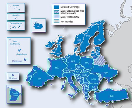
Overview: Navigate the streets of Europe with confidence. This product provides detailed road maps and points of interest for your compatible device, so you can navigate with exact, turn-by-turn directions to any address or intersection. Route to restaurants, gas stations, lodging, attractions and more.
•Includes more than 10.8 million km (6.7 million mi) of roads, including motorways, national and regional thoroughfares and local roads, in Europe.
•Displays more than 6.7 million points of interest throughout the country, including restaurants, lodging, border crossings, attractions, petrol stations, campsites, shopping and more.
•Gives turn-by-turn directions on your compatible device.
•Speaks street names (example: "Turn right on Main Street")
•Includes navigational features, such as turn restrictions, roundabout guidance, speed categories and more.
•Contains traffic data for compatible devices that use traffic receivers.
More Information
Download Instructions:
inside
unlocked gmap folder
unlocked 3d file
jcv,
hoster
filefactory.com
share-online.biz
Requirements: garmin devices, PC
Overview: Navigate the streets of Europe with confidence. This product provides detailed road maps and points of interest for your compatible device, so you can navigate with exact, turn-by-turn directions to any address or intersection. Route to restaurants, gas stations, lodging, attractions and more.
•Includes more than 10.8 million km (6.7 million mi) of roads, including motorways, national and regional thoroughfares and local roads, in Europe.
•Displays more than 6.7 million points of interest throughout the country, including restaurants, lodging, border crossings, attractions, petrol stations, campsites, shopping and more.
•Gives turn-by-turn directions on your compatible device.
•Speaks street names (example: "Turn right on Main Street")
•Includes navigational features, such as turn restrictions, roundabout guidance, speed categories and more.
•Contains traffic data for compatible devices that use traffic receivers.
More Information
- Code:
https://buy.garmin.com/en-US/US/maps/prod6299.html
Download Instructions:
- Hidden Content
- This board requires you to be registered and logged-in to view hidden content.
inside
unlocked gmap folder
unlocked 3d file
jcv,
hoster
filefactory.com
share-online.biz
Re: City Navigator Europe NT 2017.10
Fri May 13, 2016 1:54 pm
magnet link not working.
best regards
best regards
Re: City Navigator Europe NT 2017.10
Sun May 22, 2016 4:15 pm
When I download the unlocked map, my Garmin says that this map is 2015.20. NOT 2017.10.
Can you upload correct map ?
Can you upload correct map ?
Re: City Navigator Europe NT 2017.10
Sat May 28, 2016 12:54 pm
Hi All,
after installed Garmin Garmin City Navigator Europe NT 2017.10 in Programs and features on my pc shows only 4.23Gb. The Garmin City Navigator Europe NT 2016.20 was 8.25Gb
Is that normal?
thanks
after installed Garmin Garmin City Navigator Europe NT 2017.10 in Programs and features on my pc shows only 4.23Gb. The Garmin City Navigator Europe NT 2016.20 was 8.25Gb
Is that normal?
thanks
Re: City Navigator Europe NT 2017.10
Sat May 28, 2016 8:37 pm
Never map of CN Europe NT/NTU was not greater than 4.5-5 GB 
Perhaps you used 2 or more maps on your nuvi
Perhaps you used 2 or more maps on your nuvi
Re: City Navigator Europe NT 2017.10
Sun May 29, 2016 10:01 am
hello,
after having to download the map, how we put it on GPS. please
after having to download the map, how we put it on GPS. please
Re: City Navigator Europe NT 2017.10
Sun May 29, 2016 10:06 am
Copy/paste
But delete old map
Sent from my GT-I9505 using Tapatalk
But delete old map
Sent from my GT-I9505 using Tapatalk
Re: City Navigator Europe NT 2017.10
Tue Jun 07, 2016 9:53 am
Hi,I have downloaded full package Garmin - CityNavigator Europe NT 2017.10 (last message) but how to use it?No file for install it?
Re: City Navigator Europe NT 2017.10
Tue Jun 07, 2016 10:20 am
download gmapsupp img (IMG.UNL from my post) and just copy/paste
Re: City Navigator Europe NT 2017.10
Tue Jun 07, 2016 4:28 pm
Hi all,
After "installing" all, map and jcv files in the SD memory card, i made a simulation and jcv does not work!!!!
Anyone know how to solve this !!!
I'm using Garmin Nuvi 55.
Thanks
After "installing" all, map and jcv files in the SD memory card, i made a simulation and jcv does not work!!!!
Anyone know how to solve this !!!
I'm using Garmin Nuvi 55.
Thanks
Re: City Navigator Europe NT 2017.10
Sat Jun 18, 2016 3:50 pm
Hi Palves! first you have to have the same package of map files. After you have to put the .JCV files in the proper directory and last thing be sure that in the area you are searching there are available junctions views.
Re: City Navigator Europe NT 2017.10
Wed Jun 29, 2016 7:43 pm
Hi, firstly thanks for the maps, they appear perfectly in my (old) 1390, and apologies if this is covered elsewhere, but what are the other files? I've assumed I need Lane Assist JCV, and downloaded that, but not sure about the 3D, .G2S, and .ASR files are, and if I am able to use them? Thanks in advance.
Re: City Navigator Europe NT 2017.10
Thu Jun 30, 2016 3:52 am
The other files that you mentioned are for newer messages 3D buildings ASR phonetic guidance etc you don't need them
Re: City Navigator Europe NT 2017.10
Thu Jun 30, 2016 7:57 am
Hi kolokythas. Many thanks, I found the old thread explaining them so apologies for the question, though I do have one more. Are the two types of JCV file able to be used or is it model specific? ie is full screen JCV an older variant only used by older models, or am I able to choose which one I prefer? Again, many thanks in advance.