Bulgaria OFRM Geotrade 2014 Q3
Fri Oct 17, 2014 5:51 pm
The new version Q3 2014 is now available for download on our website all users with an active subscription to updates. As always, we want to express our special thanks to all the customers and friends who sent us information found inaccuracies in the previous version, actively helping to refine the map!
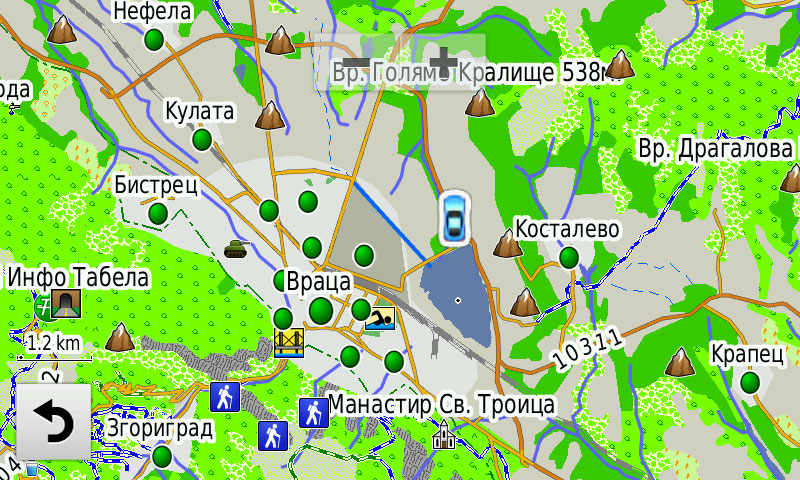
Updates urban and national road network
In Q3 2014 version added new orbital arc in Vratsa and new junction 'Balgarovo' motorway 'Thrace'.
Expanded coverage settlements
Enriched information is available for search by address (street and number) with eight new cities.
Added new items of public interest (POI)
Additional options for MapSource
Users OFRM Geotrade card with support for working with PC now have a choice between several varieties of card MapSource, to be able to use the most of the card according to the individual needs and technical possibilities.
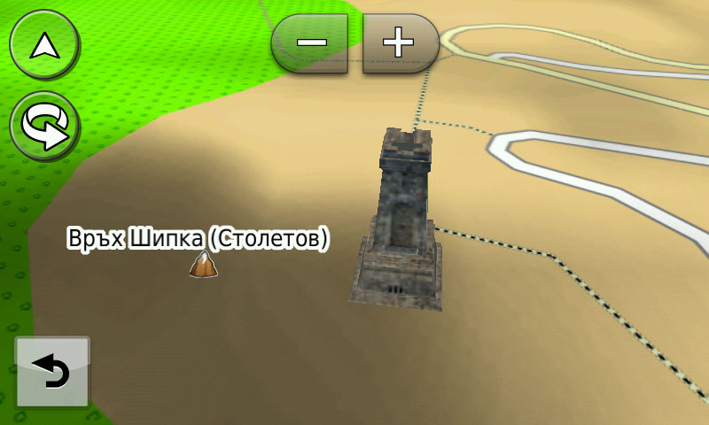
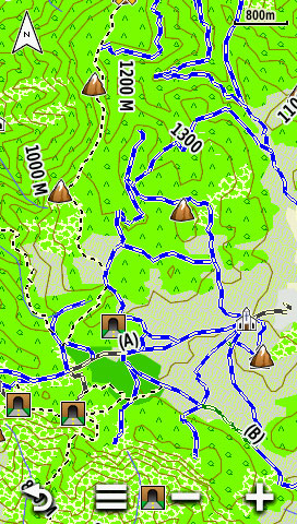
For lovers of off-road and tourism
Updated Data on the 100 national tourist sites.
Off-road enthusiasts and mountaineers have available new 331 km ofroud areas and 23 miles of hiking and biking paths.
Confident that the new version of the card OFRM Geotrade will be more convenient and useful for an ever wider range of users, we wish you and priyatno bezopasno patuvane throughout Bulgaria!
CITY CYR/LAT
unl.img/3d/jcv
- Hidden Content
- This board requires you to be registered and logged-in to view hidden content.
TOPO CYR/LAT
unl.img/3d/jcv/izo
- Hidden Content
- This board requires you to be registered and logged-in to view hidden content.
TOPO LT CYR/LAT
unl.img/jcv/izo
- Hidden Content
- This board requires you to be registered and logged-in to view hidden content.
custom made ms version unlocked from img file
only for view
right mouse button on install.bat and run as administrator
thats all
- Hidden Content
- This board requires you to be registered and logged-in to view hidden content.
OFRM Geotrade CITY
OFRM Geotrade CITY is aimed at users who use GPS navigation in urban environments. The card comes in three versions: Cyrillic, Latin and combined version is optimized for maximum performance.
OFRM Geotrade TOPO
OFRM Geotrade TOPO e designed for enthusiasts who use GPS navigation both road and off. TOPO options have additional data on off roads, rivers, vegetation cover and Digital Elevation Model (DEM), and also have built-in 25 m contours that can be included or excluded from menu to work with card products. Lightweight TOPO LT variants in the name index is intended for devices with less processor that can operate with sufficient speed to complete TOPO options. TOPO SPLIT CYR is intended only for four models of the series nuvi, where because of defect control software for the exclusion of one layer of card (eg contours) and off the map.
IMPORTANT: Due to circumstances beyond our control software limits for the ML version of the card unconventional POI points can only be invoked in Latin (as these types of POI items not provided alternative language name). Moreover, demand for the ML option takes more time (as the names of objects are twice more - in Cyrillic and Latin). If you purchased the card OFRM Geotrade the SD medium, note that it is installed namely ML option. To avoid the above limitations, we recommend that you select and install option only in Cyrillic or Latin, according to your preferences.