BlueChart g2 Vision - VEU004R - Irish Sea 2014.0 (15.50)
Thu Jul 24, 2014 11:33 pm
BlueChart g2 Vision - VEU004R - Irish Sea 2014.0 (15.50)
See your vessel’s precise, on-chart position in relation to navaids, coastal features and restricted areas with premium features found in this detailed marine mapping data. Includes all of the features of our BlueChart® g2 product, plus 3-D perspective above and below the waterline, Auto Guidance, high-resolution imagery, and aerial photos of ports, harbors, marinas and landmarks.
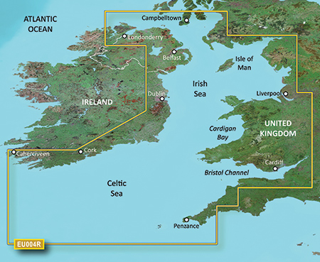
British coast: covers from Port Ellen on the Isle of Islay to Falmouth, including the Isle of Man and the Isles of Scilly. Irish coast: covers from Sheep Haven to Caherciveen, Republic of Ireland, including Londonderry, The Storks, Belfast, and Dublin.
FID: 3247, PID: 1, RID: 2, VID: 11
Locked Image:
UnLocked Image:
See your vessel’s precise, on-chart position in relation to navaids, coastal features and restricted areas with premium features found in this detailed marine mapping data. Includes all of the features of our BlueChart® g2 product, plus 3-D perspective above and below the waterline, Auto Guidance, high-resolution imagery, and aerial photos of ports, harbors, marinas and landmarks.
- Shaded depth contours, coastlines, spot soundings, navaids, port plans, wrecks, obstructions, intertidal zones, restricted areas and IALA symbols.
- Seamless transitions between zoom levels and more continuity across chart boundaries.
- High resolution satellite imagery for a realistic view of the land and water.
- Aerial photos of ports, harbors, marinas, waterways, navigational landmarks and other POIs.
- Auto Guidance technology searches chart data to suggest the best passage to a destination.
- MarinerEye view 3-D perspective for a quick, easy position fix.
- FishEye view 3-D perspective for an underwater view of the sea floor.
- Safety Shading* enables contour shading for all depth contours shallower than your defined safe depths.
- Fishing Charts* to scope out bottom contours and depth soundings with less visual clutter on the display.
- Plan and organize routes from your computer with HomePort™ (sold separately).
British coast: covers from Port Ellen on the Isle of Islay to Falmouth, including the Isle of Man and the Isles of Scilly. Irish coast: covers from Sheep Haven to Caherciveen, Republic of Ireland, including Londonderry, The Storks, Belfast, and Dublin.
FID: 3247, PID: 1, RID: 2, VID: 11
Locked Image:
UnLocked Image:
- Code:
https://buy.garmin.com/en-US/US/maps/prod9182.html
Re: BlueChart g2 Vision - VEU004R - Irish Sea 2014.0 (15.50)
Wed Jul 30, 2014 4:28 pm
Re: BlueChart g2 Vision - VEU004R - Irish Sea 2014.0 (15.50)
Tue Nov 15, 2016 8:14 pm
Hello kind sir. Can you please repost a mirror of this map? The link appears to be expired 
Re: BlueChart g2 Vision - VEU004R - Irish Sea 2014.0 (15.50)
Sun Jun 20, 2021 6:30 pm
Reuploaded
- Hidden Content
- This board requires you to be registered and logged-in to view hidden content.
Re: BlueChart g2 Vision - VEU004R - Irish Sea 2014.0 (15.50)
Wed Jan 29, 2025 5:33 pm
Hello, I am looking for 2022 Garmin G2 (with or without Vision) VEU004R Irish Sea charts. These kind links are too old and newer charts are available. Can anyone share the 2022 version please? If 2022 is not available, I would still love the 2014 version previously shared in this thread!
Thank you!
Thank you!