BlueChart g2 - HUS027R - Hawaiian Islands-Mariana Islands 2014.5 (16.00)
Tue Jan 27, 2015 2:16 pm
BlueChart g2 - HUS027R - Hawaiian Islands-Mariana Islands 2014.5 (16.00)
See your vessel’s precise, on-chart position in relation to navaids, coastal features, anchorages, obstructions, waterways, restricted areas and more with this detailed marine mapping data.
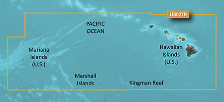
Coverage of the Pacific Ocean from the Hawaiian to Mariana Islands. Includes coverage of Guam, Midway, and Johnston Atoll. General coverage of Palmyra Atoll and the Marshall Islands also included.
FID: 3486, PID: 1, RID: 1, VID: 38
[COLOR="#800000"]Locked[/COLOR] Image:
[COLOR="#800000"]UnLocked[/COLOR] Image:
See your vessel’s precise, on-chart position in relation to navaids, coastal features, anchorages, obstructions, waterways, restricted areas and more with this detailed marine mapping data.
- Shaded depth contours, coastlines, spot soundings, navaids, port plans, wrecks, obstructions, intertidal zones, restricted areas and IALA symbols.
- Seamless transitions between zoom levels and more continuity across chart boundaries.
- Standard 2-D direct overhead or 3-D “over the bow” map perspective for easy chart reading and orientation.
- Safety Shading* enables contour shading for all depth contours shallower than your defined safe depths.
- Fishing Charts* to scope out bottom contours and depth soundings with less visual clutter on the display.
- Plan and organize routes from your computer with HomePort™ (sold separately).
Coverage of the Pacific Ocean from the Hawaiian to Mariana Islands. Includes coverage of Guam, Midway, and Johnston Atoll. General coverage of Palmyra Atoll and the Marshall Islands also included.
FID: 3486, PID: 1, RID: 1, VID: 38
[COLOR="#800000"]Locked[/COLOR] Image:
[COLOR="#800000"]UnLocked[/COLOR] Image:
- Code:
https://buy.garmin.com/en-US/US/prod33586.html
Re: BlueChart g2 - HUS027R - Hawaiian Islands-Mariana Islands 2014.5 (16.00)
Wed Jan 28, 2015 4:56 pm