BlueChart g2 - HPC018R - New Caledonia-Fiji 2014.0 (15.50)
Fri Mar 28, 2014 9:53 pm
BlueChart g2 - HPC018R - New Caledonia-Fiji 2014.0 (15.50)
See your vessel’s precise, on-chart position in relation to navaids, coastal features, anchorages, obstructions, waterways, restricted areas and more with this detailed marine mapping data.
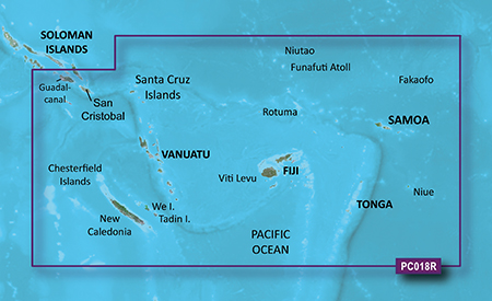
Detailed coverage of New Caledonia including Port de Muéo, Noumea, Port de Pouebo, and Baie de Yaté, as well as the isles of Ouvéa, Lifo, and Maré. General coverage of the southeastern Solomon Islands including Guadalcanal, San Cristobal, and the southern portion of Malaita. General coverage continues among the Santa Cruz Island, Vanuatu, Fiji, Tonga, Samoa, and American Samoa, including numerous detailed plans such as Port-Vila, Van., Suva, Fij., Nuku'alofa, Ton., Apia, Sam., and Pago Pago, Am. Sam.
FID: 3260, PID: 1, RID: 3, VID: 27
Locked Image:
UnLocked Image:
See your vessel’s precise, on-chart position in relation to navaids, coastal features, anchorages, obstructions, waterways, restricted areas and more with this detailed marine mapping data.
- Shaded depth contours, coastlines, spot soundings, navaids, port plans, wrecks, obstructions, intertidal zones, restricted areas and IALA symbols.
- Seamless transitions between zoom levels and more continuity across chart boundaries.
- Standard 2-D direct overhead or 3-D “over the bow” map perspective for easy chart reading and orientation.
- Safety Shading* enables contour shading for all depth contours shallower than your defined safe depths.
- Fishing Charts* to scope out bottom contours and depth soundings with less visual clutter on the display.
- Plan and organize routes from your computer with HomePort™ (sold separately).
Detailed coverage of New Caledonia including Port de Muéo, Noumea, Port de Pouebo, and Baie de Yaté, as well as the isles of Ouvéa, Lifo, and Maré. General coverage of the southeastern Solomon Islands including Guadalcanal, San Cristobal, and the southern portion of Malaita. General coverage continues among the Santa Cruz Island, Vanuatu, Fiji, Tonga, Samoa, and American Samoa, including numerous detailed plans such as Port-Vila, Van., Suva, Fij., Nuku'alofa, Ton., Apia, Sam., and Pago Pago, Am. Sam.
FID: 3260, PID: 1, RID: 3, VID: 27
Locked Image:
UnLocked Image:
- Code:
https://buy.garmin.com/en-US/digital/maps/on-the-water-maps/bluechart-g2-interactive-maps/hpc018r-new-caledonia-fiji/prod33610.html
Re: BlueChart g2 - HPC018R - New Caledonia-Fiji 2014.0 (15.50)
Wed Apr 02, 2014 5:30 am