BlueChart g2 - HEU461S - Thames Estuary 2014.0 (15.50)
Tue Jul 15, 2014 7:08 pm
BlueChart g2 - HEU461S - Thames Estuary 2014.0 (15.50)
See your vessel’s precise, on-chart position in relation to navaids, coastal features, anchorages, obstructions, waterways, restricted areas and more with this detailed marine mapping data.
Great Yarmouth to Folkestone, including Thames Estuary and River to Teddington Lock
FID: 3255, PID: 1, RID: 5, VID: 22
Locked Image:
UnLocked Image:
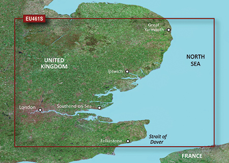
See your vessel’s precise, on-chart position in relation to navaids, coastal features, anchorages, obstructions, waterways, restricted areas and more with this detailed marine mapping data.
- Shaded depth contours, coastlines, spot soundings, navaids, port plans, wrecks, obstructions, intertidal zones, restricted areas and IALA symbols.
- Seamless transitions between zoom levels and more continuity across chart boundaries.
- Standard 2-D direct overhead or 3-D “over the bow” map perspective for easy chart reading and orientation.
- Safety Shading* enables contour shading for all depth contours shallower than your defined safe depths.
- Fishing Charts* to scope out bottom contours and depth soundings with less visual clutter on the display.
- Plan and organize routes from your computer with HomePort™ (sold separately).
Great Yarmouth to Folkestone, including Thames Estuary and River to Teddington Lock
FID: 3255, PID: 1, RID: 5, VID: 22
Locked Image:
UnLocked Image:
- Code:
https://buy.garmin.com/en-US/US/maps/prod72403.html
Re: BlueChart g2 - HEU461S - Thames Estuary 2014.0 (15.50)
Wed Jul 16, 2014 9:21 pm
Re: BlueChart g2 - HEU461S - Thames Estuary 2014.0 (15.50)
Mon Jun 12, 2017 3:38 pm
Thank you for the original upload, but all the links seem to be dead. I'd be very grateful if somebody had these files stored and would reupload them!! (there's a torrent floating about as well, but no seeders  )
)
Best regards!
)Best regards!
Re: BlueChart g2 - HEU461S - Thames Estuary 2014.0 (15.50)
Mon Jul 03, 2017 3:52 am
i could do with this one too  but as the poster above mentions the links are down
but as the poster above mentions the links are down