BlueChart g2 - HEU047R - Gulf of Bothnia-Kalix-Grisslehamn 2014.0 (15.50)
Sat May 10, 2014 8:42 pm
BlueChart g2 - HEU047R - Gulf of Bothnia-Kalix-Grisslehamn 2014.0 (15.50)
See your vessel’s precise, on-chart position in relation to navaids, coastal features, anchorages, obstructions, waterways, restricted areas and more with this detailed marine mapping data.
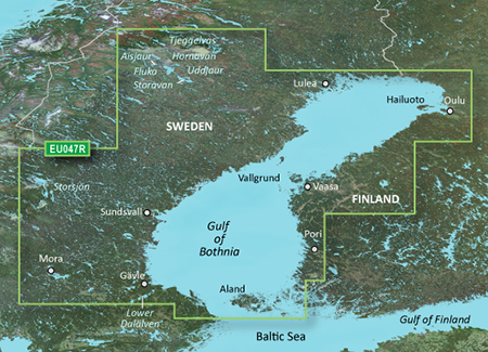
Detailed coverage of the Gulf of Bothnia from Gavle, SE through Pori, FI including Oulu and Vaasa, FI. Swedish coverage includes Luleå Skärgård, and Lakes Tjeggelvas, Hornavan, Siljan, Aisjaur, Fluka, Uddjaur, Storavan, Revsundssjön and Storsjön as well as coverage of the lower Dalälven from Gysinge to Söderfors. Coverage of the islands of Hailuoto, Vallgrund, and Åland is also included.
FID: 3256, PID: 1, RID: 2, VID: 50
Locked Image:
UnLocked Image:
See your vessel’s precise, on-chart position in relation to navaids, coastal features, anchorages, obstructions, waterways, restricted areas and more with this detailed marine mapping data.
- Shaded depth contours, coastlines, spot soundings, navaids, port plans, wrecks, obstructions, intertidal zones, restricted areas and IALA symbols.
- Seamless transitions between zoom levels and more continuity across chart boundaries.
- Standard 2-D direct overhead or 3-D “over the bow” map perspective for easy chart reading and orientation.
- Safety Shading* enables contour shading for all depth contours shallower than your defined safe depths.
- Fishing Charts* to scope out bottom contours and depth soundings with less visual clutter on the display.
- Plan and organize routes from your computer with HomePort™ (sold separately).
Detailed coverage of the Gulf of Bothnia from Gavle, SE through Pori, FI including Oulu and Vaasa, FI. Swedish coverage includes Luleå Skärgård, and Lakes Tjeggelvas, Hornavan, Siljan, Aisjaur, Fluka, Uddjaur, Storavan, Revsundssjön and Storsjön as well as coverage of the lower Dalälven from Gysinge to Söderfors. Coverage of the islands of Hailuoto, Vallgrund, and Åland is also included.
FID: 3256, PID: 1, RID: 2, VID: 50
Locked Image:
UnLocked Image:
- Code:
https://buy.garmin.com/en-US/US/maps/on-the-water-maps/bluechart-g2-interactive-maps/heu047r-gulf-of-bothnia-kalix-grisslehamn/prod34799.html
Re: BlueChart g2 - HEU047R - Gulf of Bothnia-Kalix-Grissleha
Wed Jul 21, 2021 5:42 am
Can you reupload this please.
Re: BlueChart g2 - HEU047R - Gulf of Bothnia-Kalix-Grissleha
Wed Jul 21, 2021 8:49 am
Its unlikely to be found. HEU800X includes this region new-maps/bluechart-heu800x-northern-europe-2014-v15-t15518.html
I have re-uploaded it
I have re-uploaded it
Re: BlueChart g2 - HEU047R - Gulf of Bothnia-Kalix-Grissleha
Wed Jul 21, 2021 10:20 am
I found an old version (c. 2008)
- Hidden Content
- This board requires you to be registered and logged-in to view hidden content.