BlueChart g2 - HEU015R - Aegean Sea & Sea of Marmara v2015.0 (v16.50)   

BlueChart g2 - HEU015R - Aegean Sea & Sea of Marmara v2015.0 (v16.50)

Postby bam-bam » Thu May 14, 2015 2:05 pm

Image

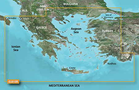
PID 1, FID 3647, region 2,21

unl.img

This board requires you to be registered and logged-in to view hidden content.
bam-bam offline


User avatar Ex Moderator


Joined: Fri Jul 23, 2010 9:43 pm
Posts: 1420
Location: .BG
Has thanked: 51 times
Been thanked: 2003 times
Age: 44

Re: BlueChart g2 - HEU015R - Aegean Sea & Sea of Marmara v2015.0 (v16.50)

Postby huntsman » Thu May 14, 2015 5:57 pm

BlueChart g2 - HEU015R - Aegean Sea & Sea of Marmara 2015.0 (16.50)

See your vessel’s precise, on-chart position in relation to navaids, coastal features, anchorages, obstructions, waterways, restricted areas and more with this detailed marine mapping data.
  • Shaded depth contours, coastlines, spot soundings, navaids, port plans, wrecks, obstructions, intertidal zones, restricted areas and IALA symbols.
  • Seamless transitions between zoom levels and more continuity across chart boundaries.
  • Standard 2-D direct overhead or 3-D “over the bow” map perspective for easy chart reading and orientation.
  • Safety Shading* enables contour shading for all depth contours shallower than your defined safe depths.
  • Fishing Charts* to scope out bottom contours and depth soundings with less visual clutter on the display.
  • Plan and organize routes from your computer with HomePort™ (sold separately).
Coverage
Including all of the Greek coast and Aegean Sea; Turkey from Istanbul and Sea of Marmara to Antalya; and Brindisi, Italy.

FID 3647, PID 1, region 2,21

Locked Image:
[Please Register or Login to download file]


UnLocked Image:
[Please Register or Login to download file]

Code: Select all
https://buy.garmin.com/en-US/US/maps/prod34781.html

Image
huntsman offline


User avatar Elite Member


Joined: Fri Sep 17, 2010 8:58 pm
Posts: 970
Has thanked: 2 times
Been thanked: 1295 times

Re: BlueChart g2 - HEU015R - Aegean Sea & Sea of Marmara v2015.0 (v16.50)

Postby greenmanos » Sat Aug 22, 2015 5:16 pm

Could you upload please?

Thanks
greenmanos offline


Junior Member


Joined: Sat Aug 22, 2015 10:19 am
Posts: 2
Has thanked: 0 time
Been thanked: 0 time

Re: BlueChart g2 - HEU015R - Aegean Sea & Sea of Marmara v20

Postby panoubis » Fri Aug 02, 2019 8:47 am

Could you upload please? Παρακαλω.....
panoubis offline


Junior Member


Joined: Tue Jul 23, 2019 4:54 am
Posts: 1
Has thanked: 0 time
Been thanked: 0 time

Re: BlueChart g2 - HEU015R - Aegean Sea & Sea of Marmara v20

Postby alponba » Sat Mar 28, 2020 12:34 pm

i need it also +1
alponba offline


Junior Member


Joined: Sun Nov 03, 2019 3:08 pm
Posts: 1
Has thanked: 0 time
Been thanked: 0 time

Re: BlueChart g2 - HEU015R - Aegean Sea & Sea of Marmara v20

Postby FireFox58 » Sat Mar 28, 2020 1:30 pm

FireFox58 offline


User avatar Member


Joined: Sun Sep 25, 2011 9:10 am
Posts: 219
Location: Florence, Italy
Has thanked: 32 times
Been thanked: 531 times

Re: BlueChart g2 - HEU015R - Aegean Sea & Sea of Marmara v20

Postby ivoo1bg » Mon May 04, 2020 9:40 pm

It is OK, but not Vision. I need This part of the Mediterranean, but G2 Vision, if there is somewhere such a map.

[Please Register or Login to download file]
VEU015R - Download
PART NUMBER 010-D0444-00
ivoo1bg offline


Junior Member


Joined: Thu May 20, 2010 3:27 pm
Posts: 12
Location: Sofia, BG
Has thanked: 4 times
Been thanked: 0 time


Return to New Maps


  • Related topics
    Replies
    Views
    Last post

Who is online

Users browsing this forum: 4195443, pichitbig and 6 guests