BlueChart g2 - HAF002R - South Africa 2014.0 (15.50)
Tue Jul 22, 2014 7:59 pm
BlueChart g2 - HAF002R - South Africa 2014.0 (15.50)
See your vessel’s precise, on-chart position in relation to navaids, coastal features, anchorages, obstructions, waterways, restricted areas and more with this detailed marine mapping data.
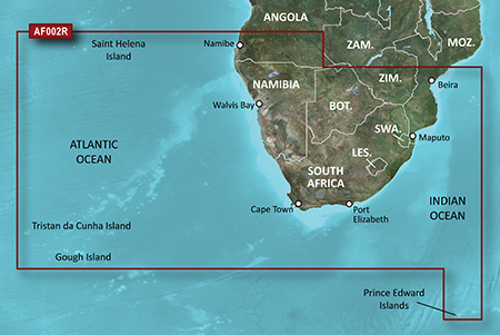
Detailed coverage of the coast of southern Africa from Namibe, Ang. to Angoche, Moz., including the South African cities of Cape Town and Port Elizabeth. Includes detailed coverage of Durban S. Af. and Maputo, Moz. Also includes detailed coverage of the Tristan da Cunha Group, the island of St. Helena, and the Prince Edward Islands.
FID: 3256, PID: 1, RID: 2, VID: 2
Locked Image:
UnLocked Image:
See your vessel’s precise, on-chart position in relation to navaids, coastal features, anchorages, obstructions, waterways, restricted areas and more with this detailed marine mapping data.
- Shaded depth contours, coastlines, spot soundings, navaids, port plans, wrecks, obstructions, intertidal zones, restricted areas and IALA symbols.
- Seamless transitions between zoom levels and more continuity across chart boundaries.
- Standard 2-D direct overhead or 3-D “over the bow” map perspective for easy chart reading and orientation.
- Safety Shading* enables contour shading for all depth contours shallower than your defined safe depths.
- Fishing Charts* to scope out bottom contours and depth soundings with less visual clutter on the display.
- Plan and organize routes from your computer with HomePort™ (sold separately).
Detailed coverage of the coast of southern Africa from Namibe, Ang. to Angoche, Moz., including the South African cities of Cape Town and Port Elizabeth. Includes detailed coverage of Durban S. Af. and Maputo, Moz. Also includes detailed coverage of the Tristan da Cunha Group, the island of St. Helena, and the Prince Edward Islands.
FID: 3256, PID: 1, RID: 2, VID: 2
Locked Image:
UnLocked Image:
- Code:
https://buy.garmin.com/en-US/US/maps/prod33839.html
Re: BlueChart g2 - HAF002R - South Africa 2014.0 (15.50)
Fri Jul 25, 2014 5:21 am
Re: BlueChart g2 - HAF002R - South Africa 2014.0 (15.50)
Wed Nov 15, 2017 8:12 pm
Please reupload.
Re: BlueChart g2 - HAF002R - South Africa 2014.0 (15.50)
Wed Nov 29, 2017 1:45 pm
the link is not working. Please send again