Forum
Forum
See your vessel’s precise, on-chart position in relation to navaids, coastal features, anchorages, obstructions, waterways, restricted areas and more with this detailed marine mapping data.
- Shaded depth contours, coastlines, spot soundings, navaids, port plans, wrecks, obstructions, intertidal zones, restricted areas and IALA symbols.
- Seamless transitions between zoom levels and more continuity across chart boundaries.
- Standard 2-D direct overhead or 3-D “over the bow” map perspective for easy chart reading and orientation.
- Safety Shading* enables contour shading for all depth contours shallower than your defined safe depths.
- Fishing Charts* to scope out bottom contours and depth soundings with less visual clutter on the display.
- Plan and organize routes from your computer with HomePort™ (sold separately).
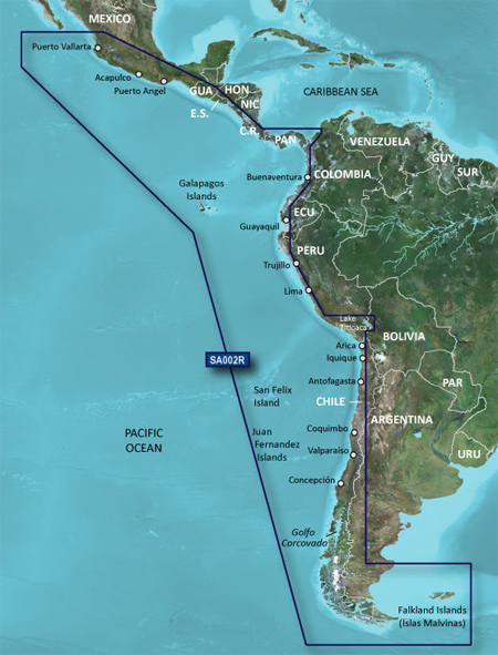
Coverage of the west coast of Central and South America from Acalpulco, Mexico to Tierra del Fuego and then north to Puerto Deseado, Argentina. Coverage also includes the east coast of Panama; the Panama Canal; the Galapagos Islands; Lake Titicaca; the Falkland Islands (Islas Malvinas); San Felix Island and the San Fernandez Islands including Selkirk.
FID: 3252, PID: 1, RID: 1, VID: 11
Locked Image:
UnLocked Image:
- Code: Select all
https://buy.garmin.com/en-US/digital/en-US/prod95508.html