TOPO Germany 2012 Pro - Original   

TOPO Germany 2012 Pro - Original

Postby huntsman » Fri Jun 08, 2012 10:54 am

TOPO Germany 2012 Pro
Version: 2012
Released: May, 2012
Part number: 010-D0752-01

Thanks to [color="#800000"]Heinrich[/color]

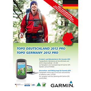
Let us guide you on all of your recreational and outdoor adventures in Germany, from the shores of the North Sea up to the summits of the Alps. This mapping product comes with new and helpful information, such as single house display and a lot of natural and cultural sites.

  • Provides precise topographic maps in reference scale of 1:25.000
  • Includes enhanced recreation trail network as well as detailed hiking trail network for touristic regions and long-distance hiking trail network (national level)
  • Provides detailed cycling network and long distance cycling network
  • Contains detailed path information for small paths, hiking trails and the whole traffic network.
  • Displays land use such as forests, lakes, streams and mountains.
  • Includes searchable street names and points of interest for recreational activities and traveling.
Features digital topographic vector maps for all of Germany.

MapID: [color="#800000"]2388[/color]

Download [color="#800000"]Locked[/color] Image:
This board requires you to be registered and logged-in to view hidden content.


Download [color="#800000"]UnLocked[/color] Image:
This board requires you to be registered and logged-in to view hidden content.


Download SQL:
This board requires you to be registered and logged-in to view hidden content.


Download [color="#800000"]UnLocked[/color] Original MapSource:
This board requires you to be registered and logged-in to view hidden content.


Code: Select all
https://buy.garmin.com/shop/shop.do?pID=97016
huntsman offline


User avatar Elite Member


Joined: Fri Sep 17, 2010 8:58 pm
Posts: 970
Has thanked: 2 times
Been thanked: 1295 times

Postby Blind Eagles » Fri Jun 08, 2012 1:45 pm

is the 1st link down? By Locked Image:
TOPO Germany Pro 2012 - Entire Country - Part1
Sorry, the server hosting the file you are requesting is currently down for maintenance. Please check back soon.
Blind Eagles offline


Junior Member


Joined: Fri Jun 08, 2012 1:42 pm
Posts: 1
Has thanked: 0 time
Been thanked: 0 time

Postby p!xeldealer » Fri Jun 08, 2012 4:28 pm

You give the answer yourself: ...is currently down for maintenance
~~~~~~~~~~~~~~~~~~~~~~~~~~~~~~~~~~~~~~~~~~~~~~~~~~~~~
The presentation of this posting exists of 100% of recycleable, taste-neutral, not genetic-
manipulated and unleaded pixels free of CFC - this guarantees for You p!xeldealer :yahoo:
p!xeldealer offline


User avatar Ex Moderator


Joined: Wed Dec 30, 2009 3:36 pm
Posts: 704
Has thanked: 352 times
Been thanked: 46 times

Postby huntsman » Fri Jun 08, 2012 6:27 pm

Blind Eagles wrote:is the 1st link down? By Locked Image:
TOPO Germany Pro 2012 - Entire Country - Part1
Sorry, the server hosting the file you are requesting is currently down for maintenance. Please check back soon.


part 1 locked mirror in first post
huntsman offline


User avatar Elite Member


Joined: Fri Sep 17, 2010 8:58 pm
Posts: 970
Has thanked: 2 times
Been thanked: 1295 times

Postby ozboss » Sat Jun 09, 2012 5:24 am

Download Instructions:
[Please Register or Login to download file] Image or [Please Register or Login to download file] Image
FID 2388
password: ozboss18

Inside:
unlocked image

hoster
netload.in
share-online.biz
ozboss offline


User avatar Ex Moderator


Joined: Mon Dec 28, 2009 3:42 pm
Posts: 336
Has thanked: 0 time
Been thanked: 372 times

Postby white_omen » Sat Jun 09, 2012 5:57 am

is the map saved as an .img - File?
white_omen offline


Junior Member


Joined: Wed Jun 06, 2012 7:41 pm
Posts: 1
Has thanked: 0 time
Been thanked: 0 time

Postby bam-bam » Sat Jun 09, 2012 11:41 am

mirror one file
locked image


copy this url


TOPO Germany Pro 2012 - Entire Country

Code: Select all
http://search.data.bg/ready/ba41cb7953969250e635a4236d906cb6


TOPO Germany Pro 2012 - SQL

Code: Select all
http://search.data.bg/ready/a5e9df1f07a68306a762cb1ffc4f37e8


in empty bar here

Code: Select all
[url]http://bgtorrentz.net/[/url]


and will recieve download link


click Свали файла(Save File)
this is not torrent !
bam-bam offline


User avatar Ex Moderator


Joined: Fri Jul 23, 2010 9:43 pm
Posts: 1420
Location: .BG
Has thanked: 51 times
Been thanked: 2004 times
Age: 44

Postby jenas » Sun Jun 10, 2012 3:37 pm

bam-bam links aren´t work.....
jenas offline


Junior Member


Joined: Thu Jul 01, 2010 3:35 pm
Posts: 76
Has thanked: 6 times
Been thanked: 3 times

Postby sergio2 » Sun Jun 10, 2012 5:40 pm

Try this links :
[Please Register or Login to download file]
[Please Register or Login to download file]
[Please Register or Login to download file]
[Please Register or Login to download file]
[Please Register or Login to download file]
[Please Register or Login to download file]
[Please Register or Login to download file]
[Please Register or Login to download file]
[Please Register or Login to download file]
[Please Register or Login to download file]

and this one for SQL folder :

[Please Register or Login to download file]
sergio2 offline


Junior Member


Joined: Sat Nov 26, 2011 1:12 pm
Posts: 11
Has thanked: 0 time
Been thanked: 0 time

...one more mirror :D

Postby Gmupakap » Sun Jun 10, 2012 6:31 pm

[SIZE="4"][color="darkgreen"]Topo Germany 2012 Pro (v5.0) - Image -Original[/color][/size]

Image

Code: Select all
https://buy.garmin.com/shop/shop.do?pID=97016


  • Provides precise topographic maps in reference scale of 1:25.000
  • Includes enhanced recreation trail network as well as detailed hiking trail network for touristic regions and long-distance hiking trail network (national level)
  • Provides detailed cycling network and long distance cycling network
  • Contains detailed path information for small paths, hiking trails and the whole traffic network.
  • Displays land use such as forests, lakes, streams and mountains.
  • Includes searchable street names and points of interest for recreational activities and traveling.


Marked Trekking and Cycling Routes in Topo Germany 2012 Pro (PDF file in German):
Code: Select all
http://static.garmin.com/shared/de/custom/topod2012/download/TopoDeutschland2012Pro_Markierte_Wege.pdf


Code: Select all
Topo Deutschland 2012 Pro
MapID: 2388

File:      J:/Garmin/TOPO_Deutschland_2012_Pro.img, length 2467168256
Header:      24.04.2012 14:08:42, DSKIMG, XOR 00, V 5.00, Ms 0, 010-D0752-01
Mapset:      Topo Deutschland 2012 Pro

Data MPS
 V: Sylt, Suderlugum, Drelsdorf, Flensburg, Kappeln, F (1)
 F: PID 1, FID 2388, Topo Deutschland 2012 Pro


[SPOILER="Download @ NETuploaded.com"][Please Register or Login to download file]
[Please Register or Login to download file]
[Please Register or Login to download file]
[Please Register or Login to download file]
[Please Register or Login to download file]
[Please Register or Login to download file]
[Please Register or Login to download file]
[Please Register or Login to download file]
[Please Register or Login to download file]
[Please Register or Login to download file]
[Please Register or Login to download file]

TYP-file with visible street names:
[Please Register or Login to download file]

ActiveRouting-SQL:
[Please Register or Login to download file]
[/spoiler]

UnLocking with Unlocker Alternative or gimgunlock necessary!

The TYP-file can replaced with Change Typ File or [Please Register or Login to download file] .

ActiveRouting works with the latest software for the Montana, Oregonx50, and 62/78 family.

More information to ActiveRouting and compatible devices on garmin.com:
Code: Select all
http://www.garmin.com/de/topo/activerouting/


[color="blue"]Thx to Pietu @ Catymag![/color]
Gmupakap offline


User avatar Junior Member


Joined: Fri Jan 27, 2012 5:42 pm
Posts: 54
Has thanked: 9 times
Been thanked: 24 times

Postby jefh » Mon Jun 11, 2012 7:09 am

What is the SQL-folder and how do I use it?
jefh offline


Junior Member


Joined: Sat Sep 25, 2010 11:41 am
Posts: 8
Has thanked: 0 time
Been thanked: 0 time

Postby jenas » Mon Jun 11, 2012 7:52 am

Technological spoken turning on/off marked hiking trails and cycling paths seems nice but there are some major disadvantages:


Those new maps don't show marked trails anymore on older GPS.
Even on a new GPS you can't see hiking trails and bicycle paths at the same time!
I converted the map for Mapsource usage but Mapsource can't show the new typ-definitions used for the trails. Basecamp is needed

I think adding an option to Basecamp and GPS firmware to show all marked trails and cycling paths at the same time would be a great improvement.

That file should be copied to the "Garmin\SQL" directory in unit or memory card for units that supports active routing.
jenas offline


Junior Member


Joined: Thu Jul 01, 2010 3:35 pm
Posts: 76
Has thanked: 6 times
Been thanked: 3 times

Postby jenas » Mon Jun 11, 2012 1:48 pm

TOPO Germany Pro 2012 - IMG + SQL
[Please Register or Login to download file]
[Please Register or Login to download file]
[Please Register or Login to download file]
jenas offline


Junior Member


Joined: Thu Jul 01, 2010 3:35 pm
Posts: 76
Has thanked: 6 times
Been thanked: 3 times

Postby sergio2 » Mon Jun 11, 2012 2:39 pm

Hi,

Has anybody tried .db file ? I put it on a SD card in Garmin/SQL/. But nothing occurs neither in Basecamp 3.3.3 nor on my Montana !
sergio2 offline


Junior Member


Joined: Sat Nov 26, 2011 1:12 pm
Posts: 11
Has thanked: 0 time
Been thanked: 0 time

Postby p!xeldealer » Mon Jun 11, 2012 4:34 pm

On Montana you must have latest beta firmware. On BaseCamp it works, if you have map img and folder SQL (with .db file) in folder Garmin on SD, USB, connected device or virtual drive.
~~~~~~~~~~~~~~~~~~~~~~~~~~~~~~~~~~~~~~~~~~~~~~~~~~~~~
The presentation of this posting exists of 100% of recycleable, taste-neutral, not genetic-
manipulated and unleaded pixels free of CFC - this guarantees for You p!xeldealer :yahoo:
p!xeldealer offline


User avatar Ex Moderator


Joined: Wed Dec 30, 2009 3:36 pm
Posts: 704
Has thanked: 352 times
Been thanked: 46 times

Next

Return to New Maps


  • Related topics
    Replies
    Views
    Last post

Who is online

Users browsing this forum: No registered users and 8 guests