
 Forum
Forum
info
- Code: Select all
https://buy.garmin.com/shop/shop.do?pID=100075
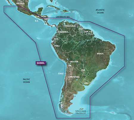
Detailed coverage of the entire South American continent including the Amazon River; Lake Titicaca; Trinidad and Tobago; the Galapagos, San Felix, Juan Fernández and Falkland Islands (Las Malvinas). Coverage also includes the Panama Canal Zone; the Caribbean coast of Central America to Bluefields, NI; the Islas de San Andrés and the Pacific coast of Central America to Las Islas Revillagigedo, MX.
lock img
PID 1, FID 2526, region 4,35
- Code: Select all
[url=http://www15.zippyshare.com/v/18189144/file.html]HSA500L_v1350.part1.rar[/url]
[url=http://www15.zippyshare.com/v/57554602/file.html]HSA500L_v1350.part2.rar[/url]
[url=http://www15.zippyshare.com/v/95040761/file.html]HSA500L_v1350.part3.rar[/url]
[url=http://www15.zippyshare.com/v/71859853/file.html]HSA500L_v1350.part4.rar[/url]
thanks to Ballebar


